Visiting Kouri Island in northern Okinawa: the 1,960-metre bridge, the Heart Rock, beaches, and what to reconfirm before you drive out.
Operational details such as opening hours, admission fees, and train times can change. Prefer official pages and reconfirm before you travel (sources checked on 02 November 2026).
Why visit
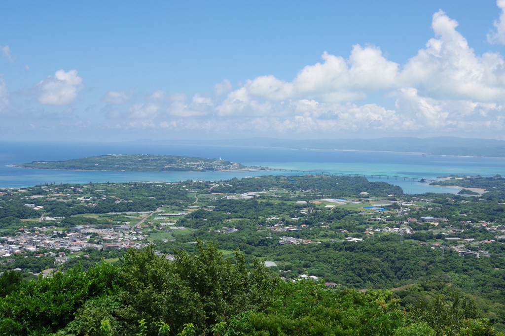
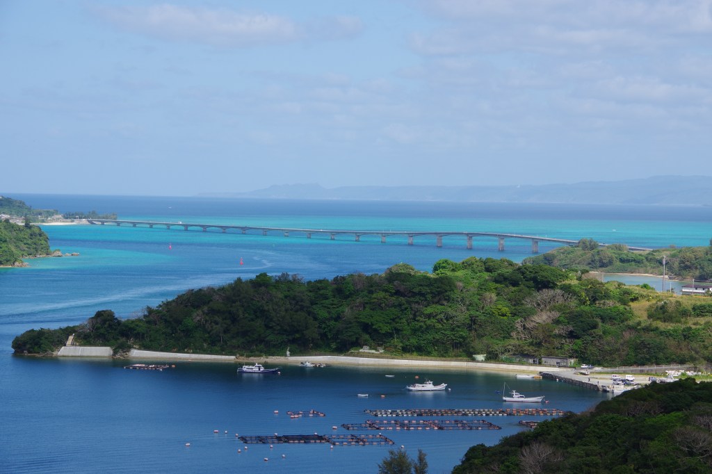
- Kouri Island is the small island at the north-eastern corner of the Motobu Peninsula, and the reason people drive there is a single piece of engineering. The Kouri Bridge links the island to Yagaji Island in Nago, runs 1,960 metres across shallow emerald water, and has been free to cross since it opened on 8 February 2005. For a few minutes you are driving on a road laid over the sea with water on both sides, and that is the experience the island is known for. It is also the second-longest toll-free bridge in Okinawa Prefecture, which tells you something about how much of this coast is connected by causeways.
- The island itself is tiny and that is the point. It is roughly a kilometre in radius with a circumference of about eight kilometres, and the loop road, the Kouri Isshu Line, takes about ten minutes by car without stopping. This is not a place you dedicate a day to. It is a two-to-three hour detour from Nago or Motobu, and the honest planning advice is to treat it as a scenic drive with two or three stops rather than a destination in its own right.
- The island has a myth that predates the bridge by a very long way. Kouri is associated with a creation story resembling that of Adam and Eve, which is why it is called the Island of the Gods and also the Island of Love, with a pun on kui, to love. The story is the reason the island draws couples and the reason the Heart Rock has become a photographic site, and it is worth knowing before you arrive because otherwise the Heart Rock looks like a rock shaped like a heart and nothing more.
- The northern coast is where the landscape is at its most interesting. Tinnu Beach holds the Heart Rock, two formations on the shore that frame a heart when seen from the car park above, and Tokai Beach has a field of pot holes, the cylindrical hollows scoured into the rock by stones spun in the surf. Both are tidal and both are best seen at the right water level, which is the single most useful thing to check before you drive out.
- The practical case for the island is that it fits between other northern Okinawa sights. It is a natural extension of a day that includes the Churaumi Aquarium area, Nakijin Castle, or the coast road up the Motobu Peninsula, and the bridge is on the route rather than at the end of a detour. What it does not offer is a resort, a large beach complex or a full day of activities, and visitors who arrive expecting that tend to be disappointed within an hour.
Top places and highlights
The Kouri Bridge
The bridge is the reason to come, and it rewards being seen twice: once from the Yagaji Island side before you cross, and once from the water-level car park at the Kouri end. It is 1,960 metres long, opened on 8 February 2005, and is free to cross. It has a wide footway and two viewpoints projecting over the sea, which is why the official tourism guidance suggests walking it rather than only driving it. On foot you get the colour of the water in a way you cannot from a moving car, and the walk is the part that turns the crossing into a memory rather than a transit.
The Heart Rock at Tinnu Beach
The Heart Rock is two rocks on the shore at Tinnu Beach that frame a heart shape when seen from the car park and the viewing area above, and it is the island’s most photographed subject. The critical detail is the tide: at high water the gap between the rocks fills and the heart shape is less clear, so the picture depends on arriving at the right state of the tide. There is a car park above the beach and a path down, and the rock should be viewed rather than climbed, since the shore is uneven and the surf reaches it.
Kouri Beach
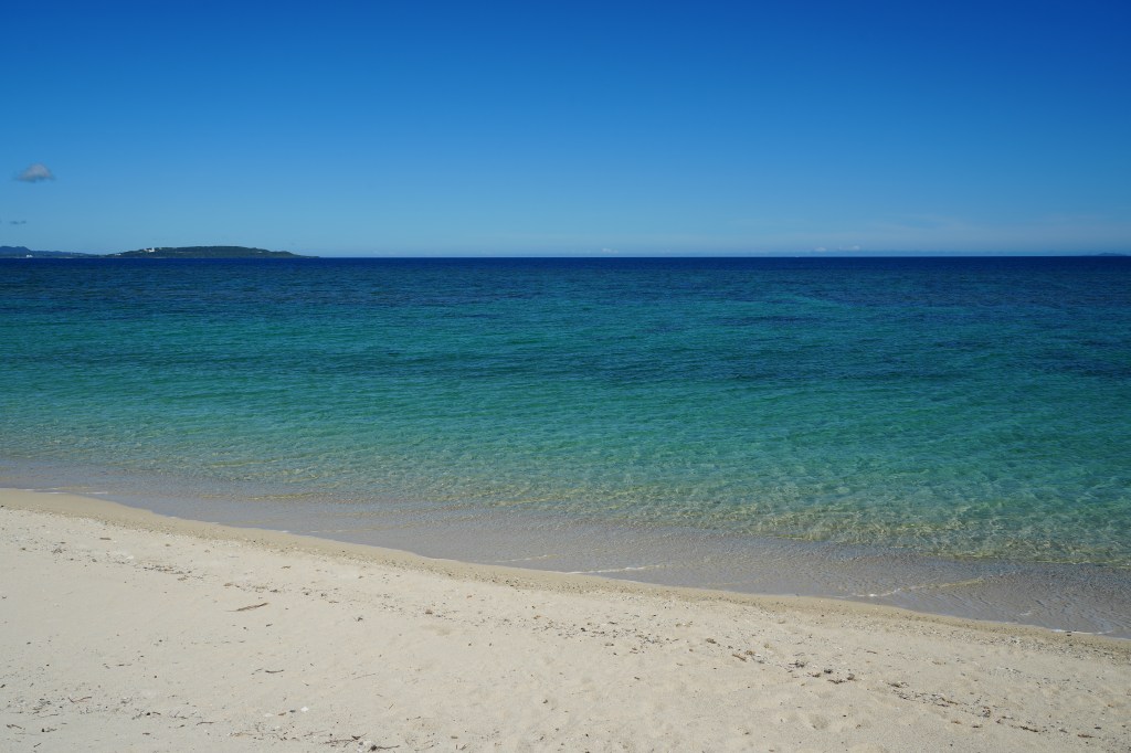
Kouri Beach sits at the island end of the bridge, immediately to the left after you cross, and it is shallow for a long way out, which is why it is the beach families use. There are shops, a restaurant, toilets and showers nearby, and it is the most convenient swimming stop on the island rather than the most beautiful. In summer it is busy, and the combination of a car park, facilities and a shallow shelf makes it the practical choice for anyone travelling with children rather than the quiet choice.
Tokai Beach and the pot holes
Tokai Beach is on the island’s coast and is known for its pot holes, cylindrical hollows scoured into the rock by stones rotated by the surf over a long period. They are a geological feature rather than a swimming spot, and they are the reason to stop here rather than pass by: the rock platform is exposed at low tide and the hollows are visible as a field of circles rather than a single dramatic formation. It is a short stop, and it is the one place on the island where the geology is more interesting than the view.
Sorahashi, the roadside station at the bridge
Kouri Island no Eki Sorahashi is the roadside station immediately to the left after crossing the bridge, at 323-1 Kouri, and it is the island’s practical base. It has a food court of about a hundred seats, a tourist information desk, rental bicycles, and a shop selling local fruit and produce, and it is open from 11:00 to 19:00 with the dining area closing at 17:00 and no regular closing day. The name means sky bridge and refers to the feeling of climbing into the sky as you cross, and the site sits above the water with the view that goes with it.
The island loop
The Kouri Isshu Line circles the island in about eight kilometres and takes roughly ten minutes by car without stopping, which makes it the fastest way to understand the place. The loop passes the beaches, the northern shore and the small settlements, and the road climbs enough to give views back over the bridge and across to Yagaji. Cycling the loop is the better version if you have the time, and rental bicycles are available at Sorahashi, which turns a ten-minute drive into an hour of looking. The road is narrow in places and the island is hilly, so it is not a flat cruise.
The creation myth and the island’s name
Kouri is called the Island of the Gods because of a creation myth that resembles the story of Adam and Eve, and the island is also called the Island of Love, a play on the name. The myth is the reason the island has a reputation as a place for couples, and it is the context that makes the Heart Rock more than a rock. The story is told in the island’s own materials and in the prefectural tourism guidance, and hearing it before you walk to the rock changes what you are looking at: the formations are the illustration of a story, not a geological coincidence with a convenient shape.
Food and drink
- The reliable meal on the island is at Sorahashi, the roadside station at the bridge, which runs a food court of about a hundred seats alongside its shop and tourist desk. It is open 11:00 to 19:00 with the dining area closing at 17:00, and it has no regular closing day, which matters on an island where small cafes keep irregular hours. The food is built around local fruit and produce rather than being a destination restaurant, and it is the option that does not depend on luck.
- The rest of the island’s eating is small and irregular. There are cafes and shops around the loop, and the pattern across northern Okinawa is that they keep thin hours outside the summer season and take irregular days off. The honest advice is to check on the day rather than plan a meal around a specific cafe, and to eat before you cross the bridge if you are arriving late in the afternoon.
- Kouri Beach has shops and a restaurant at the bridge end, which makes it the second dependable option, and it is where families end up because the facilities are there. It is not the place for a long lunch, but it covers the case where you are on the beach and do not want to drive.
- Beyond the island, Nago is the nearest town with a real choice of restaurants, about half an hour away by car, and it is where most visitors eat before or after the island. Motobu, on the other side of the peninsula, serves the aquarium traffic and has more options than the island does. The northern Okinawan dishes worth ordering, including the local soba and the pork dishes, are better found in Nago than on Kouri.
Getting there and around
- Kouri Island is reached by road, and there is no rail access. From the Okinawa Expressway, leave at the Kyoda interchange, take Route 58 north, then Prefectural Route 110 onto Yagaji Island and follow the signs to the Kouri Bridge. The prefectural tourism guidance puts the distance from Kyoda at about 28 kilometres and the drive at about 45 minutes, and the bridge is free to cross.
- By public transport the route is the Yanbaru Express Bus, using the airport line and the Shima line with a transfer, and the prefectural guidance estimates about three hours and twenty minutes. That estimate is the reason most visitors drive: the island is genuinely remote by bus, and a rental car turns a three-hour journey into forty-five minutes. Anyone relying on the bus should check the operator’s current timetable rather than planning from a guidebook, because the service is limited.
- Parking is the practical constraint. There is a free car park at the bridge foot on the Kouri side with access down to the shore, and Sorahashi has two free car parks, one with space for five large vehicles and 31 cars and a second with eight large vehicles and 75 cars. Those numbers sound generous until a summer weekend, when the bridge approach and the beach car parks fill and the road slows. Arriving before mid-morning is the difference between parking and circling.
- The bridge has a footway, so walking across is possible and is recommended by the prefectural tourism guidance. There are two viewpoints projecting over the water on the bridge, and the walk is the way to photograph the colour of the sea without stopping a car on a narrow road. The crossing is just under two kilometres each way, which is a walk rather than a stroll, and there is little shade.
- Distances within the island are short: the loop is about eight kilometres and takes roughly ten minutes by car. That means the island is not a place where transport between sights is a problem, and the constraint is parking at each stop rather than getting between them. Rental bicycles at Sorahashi are the alternative for anyone who wants to see the loop slowly without adding a car stop at every beach.
Where to stay
- The island has a small number of guesthouses and holiday rentals rather than hotels, and staying on Kouri is a choice for people who want the evening and early morning quiet rather than convenience. The trade is real: there are few restaurants, the shops close early, and a car is essential for everything including dinner.
- Nago is the practical base for the northern part of the island, about half an hour away, with the widest choice of hotels and restaurants in the region and a resort cluster along the coast. From Nago the bridge is a straightforward drive, and the town also works as a base for the aquarium and the northern forests.
- Motobu and the area around the Churaumi Aquarium has the densest concentration of resort hotels in northern Okinawa, and it is a reasonable base if the aquarium is the anchor of the trip and Kouri is a half-day. The drive from Motobu to the bridge is short, and the peninsula road is part of the appeal.
- Staying in Naha and visiting Kouri as a day trip is possible but inefficient. The drive is over an hour each way, and the island rewards an early or late arrival rather than a midday one, which a day trip from the capital makes difficult. If Kouri is a priority, base in the north for at least one night.
Best time to visit
- Summer is the season the island is built for: the water is at its clearest, the beaches are open, and the bridge crossing is the photograph everyone wants. It is also when the car parks fill, the bridge approach slows, and the small beaches are crowded. Arriving early is not a suggestion in July and August, it is the difference between a good day and an hour in traffic.
- Winter is quiet and the light is often excellent, but the island’s cafes and shops keep thin hours, the wind off the water is cold, and swimming is out. The upside is that the bridge and the Heart Rock can be seen without a crowd, and the drive along the northern coast is at its most comfortable. Check opening days rather than assuming the summer pattern holds.
- Spring and autumn are the best compromise, with warm water, manageable crowds and comfortable walking for the bridge. Spring is also when the northern part of the island is at its greenest, and autumn brings clearer air for the views back towards Yagaji. Both seasons have typhoon risk in the wider region, and a typhoon closes the bridge and empties the island, so check the forecast before committing to the drive.
- The tide matters more than the season for the two sights that define the visit. The Heart Rock reads best at low water, and the pot holes at Tokai Beach are exposed at low tide. A tide table is more useful than a weather forecast for planning the order of stops, and the difference between a good and a wasted trip to Tinnu Beach is often an hour of tide.
Practical tips
- Check the tide before you go, not after. The Heart Rock at Tinnu Beach is a pair of rocks that frame a heart only when the water is low enough, and the pot holes at Tokai Beach are exposed at low tide. Plan the order of your stops around the tide rather than around the map, because both headline sights are tidal.
- Arrive before mid-morning in summer. The car parks at the bridge and at Sorahashi are free and reasonably large, with space for over a hundred cars between the two Sorahashi lots, but they fill on summer weekends and holidays. The bridge approach is a single road, and when the car parks are full the queue backs onto it.
- Give the island two to three hours, not a day. The loop is eight kilometres and ten minutes by car, and there are three stops worth making: the beach and bridge at the island end, the Heart Rock at Tinnu, and the pot holes at Tokai, plus Sorahashi for food and information. Anyone planning a full day here will run out of things to do.
- Walk part of the bridge if the weather is good. The bridge has a wide footway and two viewpoints projecting over the water, and the colour of the sea is the reason to be on foot rather than in a car. It is just under two kilometres each way with little shade, so it is a morning or late-afternoon activity rather than a midday one.
- Do not climb down to the Heart Rock. The viewing area and the car park above give the shape, and the shore below is uneven with surf reaching it. The rock is a formation to look at, and the photograph is taken from above rather than from the water.
- Use Sorahashi as your base for the island. It has the food court, the tourist information desk, rental bicycles and two free car parks, and it is open 11:00 to 19:00 with no regular closing day. It is also the place to ask about current conditions on the beaches and which cafes are open that day.
- Do not rely on public transport without checking the timetable. The bus route requires a transfer and the prefectural guidance estimates about three hours and twenty minutes from the airport, which is long enough that most visitors should plan on a rental car. If you are using the bus, confirm the current schedule with the operator before you build a day around it.
Suggested day-trip outline
- Leave Nago or Motobu in the morning and drive north on Route 58, then Prefectural Route 110 onto Yagaji Island. Stop on the Yagaji side before the bridge for the view of the crossing, which is the better photograph of the bridge itself and takes five minutes.
- Cross the bridge and stop at the car park at the Kouri end, where you can walk down to the shore and see the bridge from below. Then continue to Sorahashi for the tourist desk, a drink and the rental bicycles if you want to ride the loop rather than drive it.
- Drive or cycle the eight-kilometre loop, stopping at Kouri Beach for the shallow water and at Tokai Beach for the pot holes. Time the northern shore for low tide, which is when both the pot holes and the Heart Rock at Tinnu Beach read properly.
- Finish at Tinnu Beach and the Heart Rock, which is the last stop before the bridge and the one that depends most on the tide. Allow fifteen minutes for the car park, the viewing area and the walk down, and do not attempt to climb to the shore.
- Eat at Sorahashi before 17:00, when the dining area closes, then cross the bridge and continue to the aquarium area or back to Nago. If you are staying in the north, the return drive at sunset gives the best light on the water, and if you are heading to Naha, leaving before dark avoids the slowest part of the expressway.
Before you go
Timetables, fares, admission fees, and seasonal access rules can change. Check the official tourism and transport sites linked below for the latest information before you travel.
Explore More of Japan
Published guides that pair with this one:
- Churaumi Aquarium Travel Guide: Whale Sharks, Mantas and the Okinawa Coast
- Nakijin Castle Ruins Travel Guide: A World Heritage Gusuku
- Okinawa Travel Guide: Discover Japan’s Tropical Paradise
- Okinawa Prefectural Museum and Art Museum Travel Guide: Highlights, Access, and Planning
- Bise Fukugi Tree Road Travel Guide: Walking Okinawa’s Green Village Tunnel
Browse every Okinawa guide on this site for the rest of the region.
Sources
- okinawastory.jp (checked 2026-11-02)
- okinawastory.jp (checked 2026-11-02)
- okinawastory.jp (checked 2026-11-02)
- okinawastory.jp (checked 2026-11-02)
- okinawastory.jp (checked 2026-11-02)
- okinawastory.jp (checked 2026-11-02)


Leave a Reply