Cape Muroto is the southeastern tip of Shikoku: a wedge of forested rock pushed into the Pacific, with a white lighthouse on top, a pilgrimage temple on the ridge behind it, and sea caves at the waterline where a young monk is said to have found enlightenment. It is also a working cape, with fishing ports, a wind-battered coastline, and a geology that records some of the largest earthquakes in Japanese history.
The first thing most visitors notice is the wind. Muroto averages about 6.8 metres per second, and the cape takes the full force of typhoons coming up from the Philippine Sea. The second is the light: on a clear day the horizon is a hard blue line, and at the right time of year the sun rises and sets over the same headland. The third is how much there is to do in a place that looks, on a map, like the end of the road.
This guide is for travellers who want more than a photo stop. It covers the lighthouse and the UNESCO Global Geopark, the Shikoku pilgrimage temple and the cave associated with Kukai, the preserved merchant town of Kiragawa, whale watching, the local food, and the buses that make a car-free visit possible, if not exactly easy. It is based on official sources checked in October 2026, including the 2026 lighthouse festival dates and the current access arrangements.
Cape Muroto at a glance
- Where: Muroto City, Kochi Prefecture, on the southeastern tip of Shikoku.
- Distance from Kochi: about two hours by car; about two and a half hours by train and bus.
- Geopark: Muroto UNESCO Global Geopark covers all of Muroto City, 248.2 square kilometres, with 51 geosites. It joined the Global Geoparks Network in 2011 and became a UNESCO Global Geopark in 2015, and it is Shikoku’s only UNESCO Global Geopark.
- Lighthouse: first lit in 1899; 15.4 metres tall, with the light 154.7 metres above the sea.
- Temple: Hotsumisakiji, temple 24 of the Shikoku 88, founded in 807.
- Cave: Mikurodo, open 08:00 to 17:00, with free loan helmets and weather closures.
- Best months: late March to May and October to November. The cape is wet and windy at any time of year.
- Time needed: one full day for the cape; two days to add Kiragawa, the museums and whale watching.
- Car-free: possible, but the bus is infrequent and the last departure is early. An overnight stay makes it much better.
- Do not miss: the lighthouse, the Ransho coastal path, Mikurodo, Hotsumisakiji and the Kiragawa streetscape.
- Note: Muroto is not a hot-spring resort town. Some hotels have large communal baths, a few use deep seawater, and SeaRest is one of them.
Last updated: 26 October 2026. Prices, timetables and event dates change; reconfirm before you travel.
Where Cape Muroto is, and why it feels like the edge of Japan
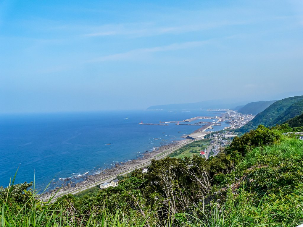
Cape Muroto lies at the southern end of the Muroto Peninsula, in eastern Kochi Prefecture. Route 55 follows the coast from Kochi city through Aki and Nahari, then climbs over the shoulder of the peninsula to the cape. The road is the main artery for fishing ports and small settlements, and it is the only practical way to reach the tip by land.
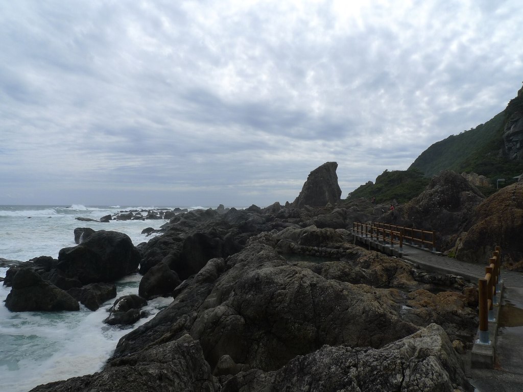
The cape itself sits at about 33 degrees 14 minutes north, 134 degrees 10 minutes east. The peninsula is mountainous: about 87 percent of Muroto City is forest and slope, and the flat land is concentrated in a few coastal strips. The coastline runs for roughly 53 kilometres, alternating between rocky headlands, small bays and concrete sea walls; the cape is part of the Muroto-Anan Kaigan Quasi-National Park. This is not a resort coast. It is a place where the mountains meet the sea abruptly, and where the weather arrives with nothing to slow it down.
The name is usually explained as muro (a cave or dwelling in a slope) and to (the entrance or door). The explanation fits the landscape: the caves at the cape were formed by waves when the sea level was higher, then lifted above the present shoreline by earthquakes. In ancient times, this was a coast of sea caves; today it is a coast of raised caves, marine terraces and wave-cut platforms, with the old sea floor now high and dry.
The Kuroshio Current runs past the cape, bringing warm, clear water and mild winters. It also supports the subtropical vegetation that makes the cape look greener and denser than much of Japan at the same latitude: Japanese sea fig, crinum lilies, ferns and broadleaf trees that survive because the sea rarely gets cold. The same current feeds the deep-water upwelling offshore, which is the basis of Muroto’s deep-seawater industry and its reputation for fish.
For all that, the cape is not a wilderness. It has a lighthouse, a paved road, a temple, a visitor centre, two small museums, a campground and a handful of hotels. The town of Muroto is a 20- to 30-minute drive north, and the fishing ports of Murotsu and Sakihama are strung along the coast. The pleasure of the place is the way those human layers sit on top of the geology: a temple on a raised marine terrace, a lighthouse on a wave-cut cliff, a merchant street built from the profits of charcoal, and a sea that is still rising, very slowly, under all of it.
A cape built by earthquakes
Cape Muroto is one of the best places in the world to see the workings of a subduction zone at human scale. About 140 kilometres offshore, the Philippine Sea Plate is sliding beneath the Eurasian Plate at the Nankai Trough. As the ocean plate descends, sediment scraped off its surface is plastered onto the continental plate, forming an accretionary complex. The rocks exposed along the Muroto coast are part of that complex: layered sandstone and mudstone of Eocene to early Miocene age, roughly 50 to 16 million years old, accreted between about 22 and 15 million years ago and folded and fractured by the same process that is still pushing the cape upward.
The result is a landscape of marine terraces. On the west coast of the peninsula, flat benches step up from the present shoreline to about 180 metres above sea level. The highest of these surfaces is thought to have formed during the last interglacial period, about 125,000 years ago, when the sea stood higher than it does now. Since then, the land has risen and the sea has cut new platforms, leaving the older ones stranded above the waves. The average uplift rate is about 1.4 metres per 1,000 years, which is fast by world standards. The cape itself is armoured by a gabbro intrusion, a hard dark rock dated to about 18 million years ago; it is one of the reasons the headland survives while softer rocks around it erode.
That uplift is not smooth. It happens in jumps, during great earthquakes. In 1946, the Showa Nankai earthquake raised the cape by about 1.15 to 1.3 metres and subsided the Kochi plain by about 1.2 metres, a seesaw motion that has been recorded after several Nankai Trough events. The 1854 Ansei Nankai earthquake raised the cape by about 1.2 metres; the 1707 Hoei earthquake is estimated to have raised it by 2 to 2.5 metres. The geological record suggests that the cape has experienced repeated uplift events of a few metres, at intervals of roughly 1,000 to 2,000 years, as well as smaller events at shorter intervals.
You can see the evidence without a guide. Look for old wave-cut notches above the present tide line, raised benches with marine shells, and beds of sandstone and mudstone tilted and fractured in ways that make no sense for a quiet coastal plain. The Muroto Global Geopark Center explains the sequence with models and a short film, and the coastal path at the cape takes you past some of the key exposures. Do not hammer off samples or collect fossils: the geopark’s geological sites are protected, and the value of the place depends on leaving them in situ.
The same subduction zone is why the cape is exposed to tsunamis. The Nankai Trough has produced large earthquakes at intervals of roughly 100 to 150 years, and the 1946 event sent waves of about 5 to 6 metres onto parts of the Kochi coast. Muroto’s raised topography is a reminder that the sea can arrive quickly. If you feel strong shaking, do not go down to the coast to look at the water. Move inland and uphill, and follow the evacuation signs. The geopark centre can tell you where the nearest high ground is.
The cape is also a typhoon coast. The 1934 Muroto Typhoon made landfall near the cape on 21 September with a central pressure of 911.6 hectopascals, the lowest pressure recorded at landfall in Japan. It killed 2,702 people and left 334 missing across the country, with terrible damage in Osaka as well as Shikoku. The lighthouse was damaged; the town was reshaped. That history is not just a weather statistic. It explains the low eaves, heavy tiles and windbreaks you see in older buildings, and it is why the local advice about typhoons is taken seriously.
For a traveller, the practical takeaway is simple. The cape is beautiful in good weather and genuinely dangerous in bad weather. Check the forecast before you drive out, especially in August and September. Do not walk the coastal path in a typhoon or a heavy swell. The waves that look dramatic from the car park can sweep the rocks and the path without warning.
The lighthouse at the end of the road
The Muroto Misaki Lighthouse stands on the hill above the cape, a white iron tower against a blue that is often almost too bright to photograph. It was first lit on 1 April 1899, and among surviving Meiji-era iron lighthouses it is the second oldest in Japan, after Hijisaki Lighthouse on Sado Island in Niigata. The tower is 15.4 metres tall, but its light sits 154.7 metres above the sea, which gives it a reach of about 49 kilometres. The lantern holds a first-order Fresnel lens about 2.6 metres across, one of only five first-order lenses in Japan; the current lens is the third generation.
The light flashes white once every ten seconds. Its intensity is 1.6 million candela. Those numbers matter less than the setting: the lighthouse stands on a grassy crown of rock, with the Pacific on three sides and the temple roof visible through the trees behind. On a clear day you can see the curve of the coast toward Kochi and, to the east, the darker outline of the peninsula falling away into the Pacific.
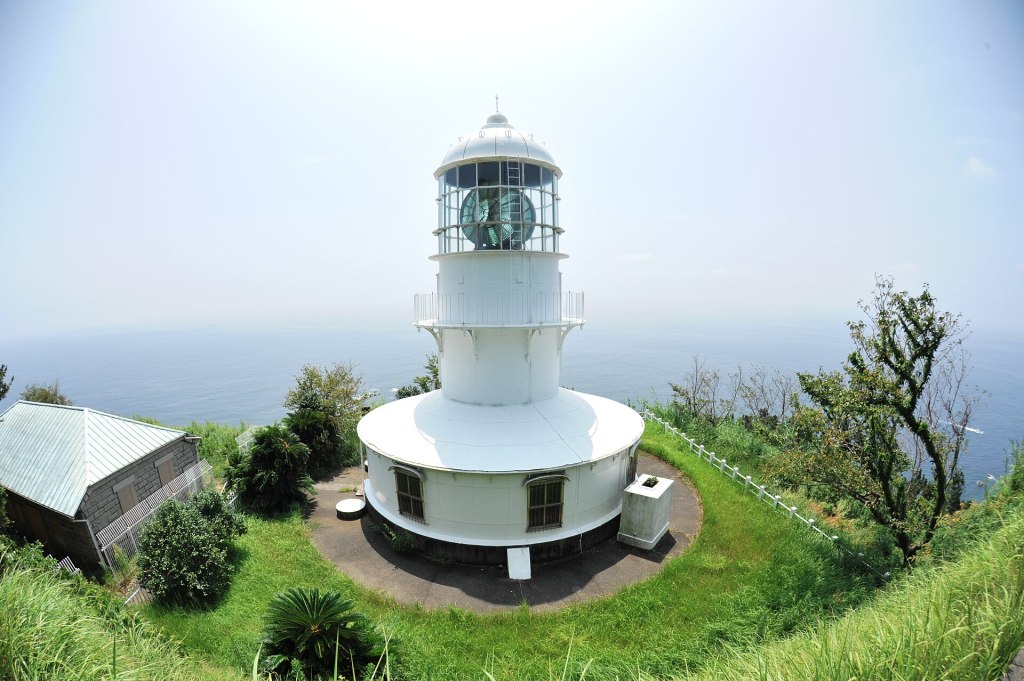
Most visitors see the lighthouse from the outside. That is normal: the tower is not generally open to the public, and the interior is opened only during the annual lighthouse festival. In 2026 the festival runs on 31 October and 1 November. The 31 October programme opens at 15:30 and runs into the evening, with a brass band from Kochi University at 16:15, a children’s lighthouse-keeper ceremony at 17:00, the lighting ceremony, an accordion performance at 18:00 and interior tours until about 18:30. The 1 November programme runs from 10:00 to 14:00, with the opening ceremony, mochi throwing and interior tours until 13:30; the Hotsumisakiji treasury is also open. The city tourism association announced the dates on 13 October 2026. Admission is free and no reservation is needed; bring cash for food and drink. If you are visiting outside those dates, plan on the exterior view and the coastal walk rather than an interior tour.
Getting there is part of the experience. By car, a narrow road climbs from the cape to a parking area shared by the lighthouse and the temple; the last stretch is steep and has limited passing space. By bus, get off at Muroto Misaki and walk up the pilgrimage path to the temple, then continue to the lighthouse: about 25 to 30 minutes uphill. The alternative stop, Skyline Entrance, is about a 32-minute walk from the lighthouse, according to the local tourism association. Neither route is difficult in dry weather, but both are exposed, and the wind can make the walk feel longer than the distance suggests.
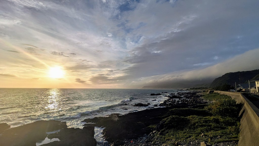
The best light is early morning, when the sun comes up over the Pacific and the lighthouse is still in cool shadow. In the evening, the west side of the cape catches the last light; from the lighthouse hill you can watch the sun go down over Tosa Bay while the east side is already in dusk. This is one of the few places in Japan where you can see both sunrise and sunset from the same cape, though not, strictly speaking, from the same spot at the same time.
There are toilets and a small rest house near the cape park, but services are limited and seasonal. The lighthouse itself has no cafe or shop. Bring water, and do not rely on finding a taxi at the cape: there is no rank, and phone reception can be patchy on the quieter stretches of the coastal path.
Walking the cape: the Ransho path, the observatory and the skyline
The cape is compact enough to walk, but the walking is more varied than it looks. The main circuit starts at the cape park, where the bus stops, and spreads east along the Ransho Promenade, a 2.6-kilometre path through subtropical forest and over wave-cut rock. The section from the cape to Mikurodo is about two kilometres. The path passes the Mikurodo cave, the Me-ara-i pond, the Bishago rock and a series of viewpoints over the Pacific. It is not a smooth promenade: there are steps, roots, uneven stone and sections without railings. Allow 40 to 60 minutes one way to Mikurodo, or about 90 minutes for the full path, more if you stop to photograph the plants and the waves.
The vegetation is one of the surprises. This is one of the few places in Japan where you can walk through a coastal forest of Japanese sea fig, with its buttressed roots and glossy leaves, while crinum lilies and other subtropical plants grow along the path. The forest is low and wind-shaped, more like a thicket than a canopy, and it opens suddenly onto black rock and white spray. The effect is closer to a tropical coast than to the cedar forests usually associated with Japan.
Near the start of the path, the cape park has a statue of Nakaoka Shintaro, the Tosa samurai assassinated in Kyoto in 1867, and a small observatory known as the Lover’s Sanctuary, with a heart-shaped monument and a view over the cape. It is a popular photo spot, and it is also a good place to understand the shape of the headland: the lighthouse on the hill, the temple behind it, the path threading east along the coast, and the open Pacific beyond.
Further east, the path reaches Mikurodo, the sea cave associated with Kukai. The cave is the spiritual centre of the walk, and it deserves more than a quick look. The entrance is low, the interior is dark and damp, and the sound of the waves fills the space. A small shrine sits inside. The city asks visitors to wear a helmet, which is loaned free at the site, and to stay out in bad weather. The cave is open from 08:00 to 17:00, but it can close without notice when the sea is rough.
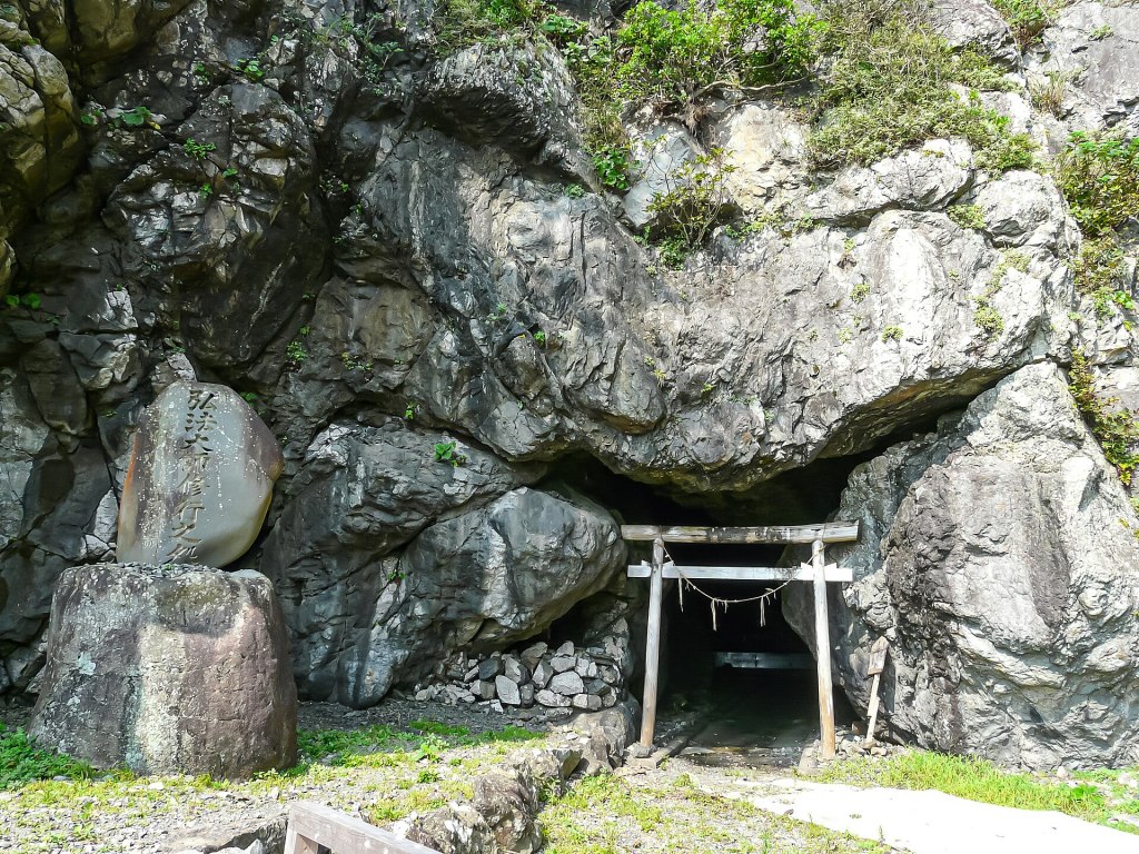
The walk continues to the Bishago rock and the Me-ara-i pond, both tied to local legends. The pond is said to have healed eye diseases; the rock is associated with a darker story. Treat these as living folk traditions rather than attractions with interpretive panels. There is little signage in English, and the path is not a theme-park trail. If you are unsure of the route, turn back at Mikurodo rather than continuing onto the rocks.
For a different view, drive the Muroto Skyline, a nine-kilometre road that runs along the ridge of the peninsula. It opened in 1970 as a toll road and has been free since 1981. The highest viewpoint is around 250 metres, with lookouts over the cape and the two sides of the peninsula. The road is narrow, with hairpin bends and few guardrails in places, and it is not lit at night. It is a good morning drive, not a night drive. In strong wind or heavy rain, skip it.
At the western end of the cape, on the boundary between Muroto Misaki and Sakihama, the Meoto Iwa, or Husband and Wife Rocks, stand in the sea. They are two vertical pillars tied with a sacred rope, and the surrounding rock has been sculpted by wind into honeycomb patterns and ripples. From the autumn equinox to the spring equinox, the sun can rise between the rocks on clear days, a phenomenon known as daruma sunrise; the best chance is from late October to mid-February. The same seasonal refraction can produce a daruma sunset on the west side of the cape. Both are weather-dependent and best photographed from a distance with a long lens; do not climb onto the rocks for a better angle.
Hotsumisakiji: temple 24 and the Kukai story
Hotsumisakiji sits on the ridge above the cape, about a 25-minute walk up the pilgrimage path from the Muroto Misaki bus stop. Its full name is Murotozan Myojo-in Hotsumisakiji, and it is the 24th temple of the Shikoku 88 Temple Pilgrimage. The sect is Shingon Buzan, the main deity is Kokuzo Bosatsu, and the founder is Kukai, the monk known after his death as Kobo Daishi. The temple was founded in 807, the year after Kukai returned from Tang China, on the site where he is said to have practiced as a young man.
The story is specific. In 792, when Kukai was 19, he came to Muroto and practiced the Kokuzo Gumonji method, a demanding meditation and chanting discipline, in the sea caves at the cape. The temple’s own history says that he wore a robe of wisteria vines, sheltered from the wind and rain, and sought a vision of the bodhisattva Kokuzo. In his later writing he described the experience in terms of the valley echoing, a bright star entering his mouth, and the light of Kokuzo filling the cave. The temple was built later, after his return from China, to mark the place where that practice reached its conclusion.
The walk up is part of the visit. The path climbs through forest, with stone steps and mossy retaining walls, and the temperature drops as soon as you leave the road. The temple grounds are quiet, with a main hall, a bell tower, and a view back over the cape and the sea. The temple is an active place of worship, not a museum: keep your voice low, do not photograph the main deity or the interior of the hall, and follow the signs for the stamp office if you are collecting pilgrim stamps. The temple office can issue the stamp and calligraphy for temple 24.
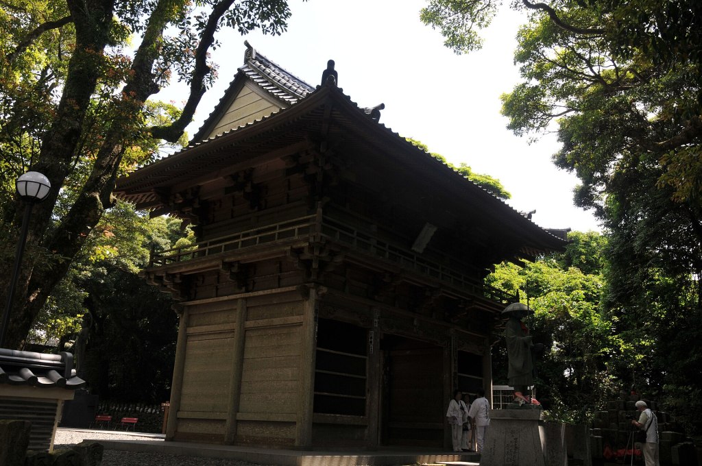
The temple holds several cultural properties, including three nationally designated Important Cultural Properties: a stone Nyoirin Kannon in a half-lotus pose, a wooden Yakushi Nyorai, and a wooden Gekko Bosatsu. Some are kept in the treasure hall, and access depends on the season and the temple’s schedule. Do not expect a curated museum display; this is a working temple with limited staff. If you are interested in the collection, ask at the office, and be prepared for a short, Japanese-language explanation.
The temple also has a henro centre, or pilgrimage lodging, with a capacity of about 20 guests. It is simple rather than luxurious: tatami rooms, shared facilities, and temple meals by arrangement. It is one of the most atmospheric places to stay near the cape, especially if you want to be at the lighthouse for sunrise before the buses start. Reserve by phone well in advance, and confirm whether meals are available and whether you need to arrive by a certain time. The temple office number is 0887-23-0024.
Hotsumisakiji is called the East Temple, while Kongochoji, temple 26, further west along the coast, is the West Temple. The pairing reflects an older geography of pilgrimage in which the two temples faced each other across the peninsula. Temple 25, Tsurushinji, is in Muroto city, near the port. If you are walking the pilgrimage route, the section around the cape is short but steep, and the heat and wind can be more tiring than the distance suggests.
Mikurodo: the cave where the sky and sea meet
Mikurodo is a sea cave at the eastern end of the Ransho path, formed by wave erosion when the sea level was higher and lifted above the present shoreline by later earthquakes. It is small, low and dark, with a shrine inside and the noise of the waves echoing through the rock. Kukai is said to have lived and practiced here as a young man, and the cave is one of the reasons the cape became a pilgrimage site.
The name is often connected to Kukai’s later name, Kukai, which is written with the characters for sky and sea. The story is that the view from the cave, with the sky above and the sea below, inspired the name. Whether or not you take the story literally, the cave does frame the elements in a striking way: a dark opening, a band of bright water, and a slice of sky. The cave is also listed as one of Japan’s 100 Soundscapes for the sound of its waves.
Practical details matter here. The cave is open from 08:00 to 17:00, but it closes in bad weather or high surf. Helmets are loaned free and must be worn; the ceiling is low and the rocks are slippery. The path from the cape bus stop takes about 20 to 25 minutes, or you can get off at Misaki Hotel Mae and walk about three minutes. There are no toilets or shops at the cave. If you are claustrophobic, wait outside; the cave is not large, and the passage is not designed for crowds.
Next to Mikurodo is Shinmeikutsu, a second cave used for training. It is not routinely open to visitors, and the entrance may be closed or unsafe. Do not duck under barriers or follow informal paths into the rock. The coastal path is a place to look, not to scramble.
The geopark centre and the small museums
The Muroto Global Geopark Center is the best first stop in the area, especially if you are interested in the geology or want to understand what you are looking at. It occupies the former Muroto East Junior High School, a short drive or bus ride from the cape, and it opened in 2015. Admission is free. Opening hours are 09:00 to 17:00, and it is normally open every day, though the shop or rest area may close for maintenance. The Geo Theater uses a large screen to explain how the cape was formed, and the exhibition covers the accretionary complex, the marine terraces, the Kuroshio Current and the relationship between the land and the people who live on it.
The centre is also the place to ask about guided geo tours, English materials and the condition of the coastal path. English signage is present but not comprehensive, and the staff are helpful if you ask specific questions. There is free parking for 44 cars and 5 large vehicles, and the bus stop is directly outside. Allow 45 to 60 minutes.
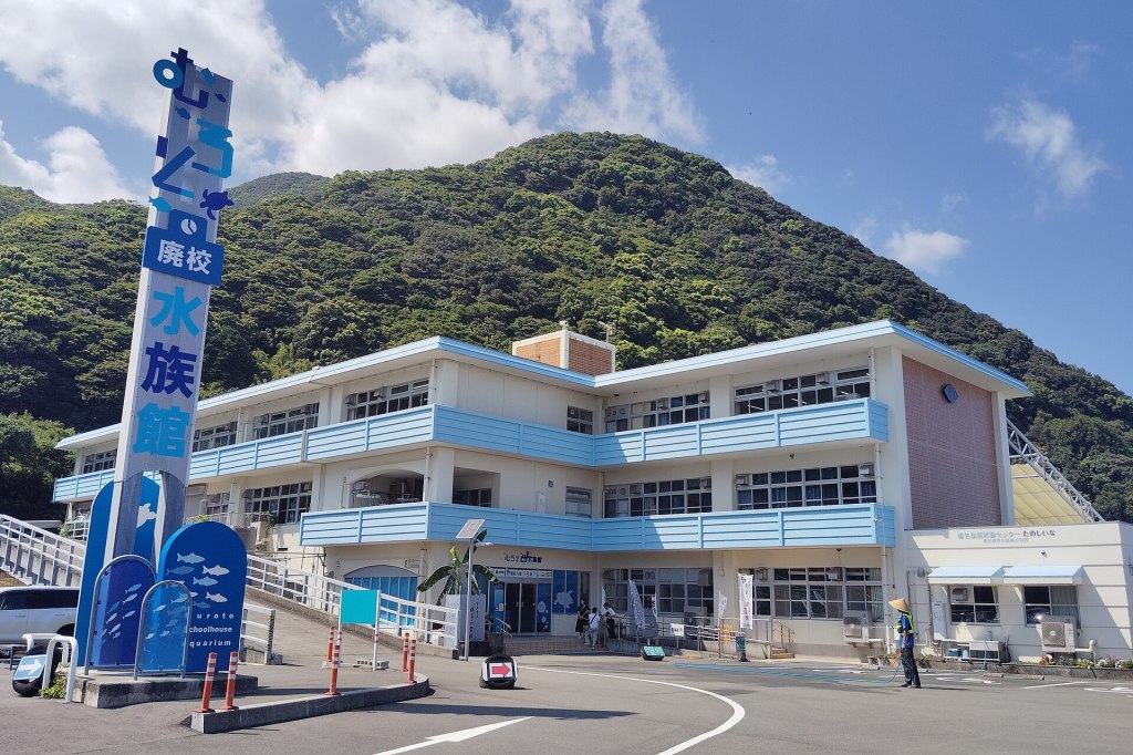
For a different kind of museum, the Muroto Schoolhouse Aquarium is about 10 minutes north of the cape, in the former Shiina Elementary School. It opened in 2018 and keeps the school building largely intact: corridors, classrooms, a library and a 25-metre outdoor pool that now holds sea turtles and small sharks. The tanks are filled with fish caught in local set nets, and the whole place has a homemade, slightly eccentric charm that is very different from a big-city aquarium. It is open every day; hours are 09:00 to 18:00 from April to September and 09:00 to 17:00 from October to March. Admission is 600 yen for adults and high-school students, 300 yen for elementary and junior-high students, and free for preschoolers.
The Kira Messe Muroto Whale Museum, at the road station of the same name in Kiragawa, tells the story of Muroto’s whaling history and the sea. It is a compact, modern museum with a large-screen digital version of a traditional whaling scroll, a virtual-reality whaling boat experience and displays on whale anatomy and local life. It is open 09:00 to 17:00, with last entry at 16:30, and closed on Mondays unless Monday is a public holiday, in which case it closes the following day. Admission is 500 yen for adults, 100 yen for elementary to high-school students, and free for preschoolers. Allow 45 to 60 minutes, and combine it with a walk around Kiragawa.
If the weather turns, SeaRest is the local rainy-day option. It is a deep-seawater health facility near the cape, with a 34-degree pool, an outdoor bath, a Finnish sauna and a restaurant. It is not a natural hot spring, and the pool is for exercise and relaxation rather than swimming. As of 2026 it is open 12:00 to 21:00 and closed on Wednesdays; pool use including bath and sauna is 1,600 yen for adults, while bath-only is 700 yen. It reopened in April 2026 after a closure, so check the current calendar before you go.
Kiragawa: the charcoal town that learned to survive typhoons
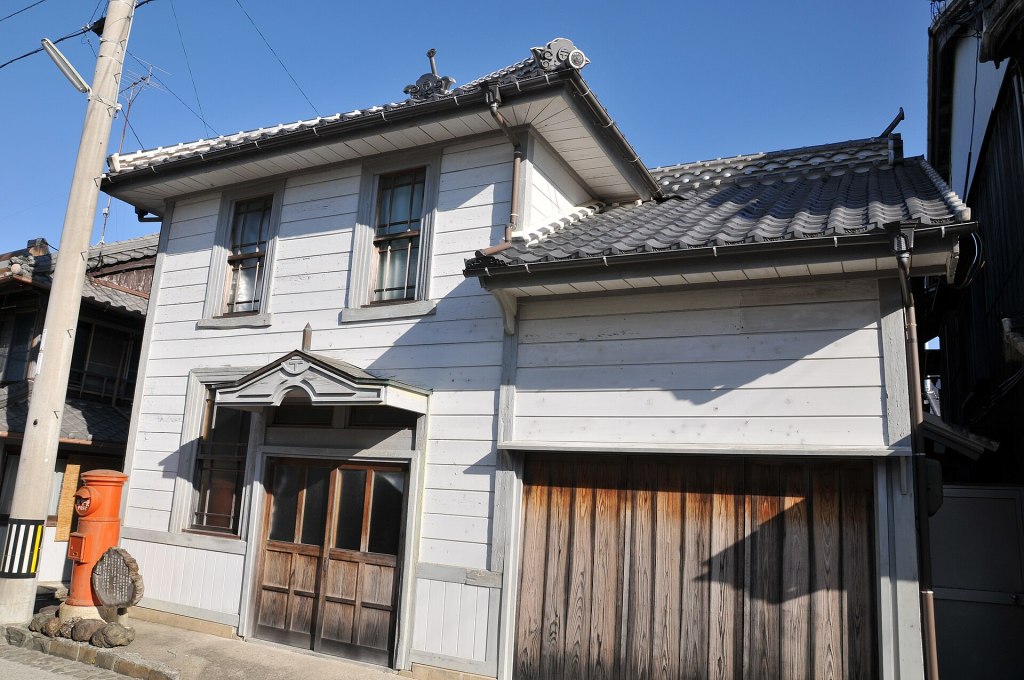
Kiragawa is a small town about 13 kilometres west of the cape, and it is one of the most rewarding detours in eastern Kochi. In the late nineteenth and early twentieth centuries it grew rich on Tosa binchotan, a hard, long-burning charcoal made from ubame oak. The charcoal was shipped to Osaka and Kyoto, and the merchants and shipping agents who handled it built the handsome streetscape that survives today. In 1997 the district was designated a Important Preservation District for Groups of Traditional Buildings, the first in Kochi Prefecture.
The architecture is distinctive because it was designed for a place that gets hit by typhoons. The houses have white Tosa plaster walls, polished by hand until they shine. The roofs are covered with water-cutting tiles, set to throw rainwater clear of the walls in a storm. The second floors are deliberately low, a style called tsushi-nikai, which reduced wind load and was often used for storage. Some walls are faced with red brick brought back from Osaka and Kobe as ballast or trade goods. The wealthier merchant houses have thick earthen storehouses with namako walls, and the upper town has ishiguro, dry-stone walls built without mortar.
The preserved area covers about 18.3 hectares and contains roughly 130 traditional buildings, plus walls, gates and other structures. It is a living neighbourhood, not an open-air museum: people live and work behind the facades, and some houses are private. Walk quietly, do not enter gardens or open gates, and ask before photographing people. The Kiragawa Machinamikan, a restored merchant house near the Onda Hachimangu shrine, has displays and can arrange local guides; the nearby Omatsurikan covers the town’s festivals. Guided walks run from about 30 minutes to an hour, and the local association charges 1,500 yen for one to five people, plus 300 yen for each additional person; book about a week ahead. Confirm the current arrangements when you book.
The town is also the best place to see the charcoal tradition that shaped the geopark. UNESCO notes that about 37 kilns in the area still produce Tosa binchotan, using ubame oak grown in the coastal forests. The charcoal is valued by chefs for burning hot and clean, with little smoke. You may see bags of it for sale in local shops, along with charcoal-related crafts and everyday goods. It is a useful reminder that the geopark is not only about rocks: it is about the relationship between the forest, the coast and the people who made a living from both.
Kiragawa is a 15- to 20-minute drive from the cape, or a bus ride on the Aki-Muroto line to the Kiragawa stop. Buses are infrequent, so check the return times before you set out. The town is quiet, with a few cafes and shops; do not expect a full tourist infrastructure. That is part of its appeal. Allow at least an hour for the streets, more if you are interested in the architecture or plan a guided walk.
Whale watching and the whaling coast
Muroto has a long whaling history. The town was a base for traditional coastal whaling, and the Kira Messe Whale Museum preserves that story alongside the natural history of the animals. Today the relationship is mostly touristic: small boats leave from Sakihama and Takako ports to look for whales and dolphins in the deep water offshore, where the Kuroshio Current and the continental shelf create rich feeding grounds.
Whale watching is possible year-round, but the best season and the species vary. One local operator says the months from December to August are best for whale sightings; another runs trips throughout the year and looks for whatever is present. Sperm whales, dolphins and other cetaceans have all been recorded in the area, but sightings are never guaranteed. A trip typically lasts three to four hours, including the boat ride out and back. Shared trips start at about 6,000 yen per adult, and private charters run from about 15,000 yen for a small group. Confirm the current price, departure time and cancellation policy directly with the operator.
The practical advice is to book ahead, especially in the best months, and to be flexible. Trips are cancelled when the sea is rough; even when they go out, the ride can be bumpy and wet. Take seasickness medication before you board if you are prone to it, wear a waterproof layer, and do not bring a camera that cannot get wet. The boats are small, and there is limited shelter. If you are travelling with young children or anyone with back or neck problems, ask the operator whether the trip is suitable.
Choose an operator that briefs passengers on life jackets, keeps a respectful distance from the animals and does not chase or feed them. Whale watching is a wild-animal encounter, not a zoo. The museum is a good place to learn what you are looking at before you go out, and it also provides context for the whaling history that shaped the town.
What to eat: bonito, alfonsino and deep-seawater salt
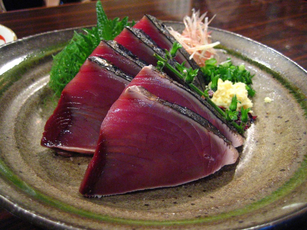
Muroto is a fishing town, and the food follows the catch. The signature dish is katsuo no tataki: bonito seared quickly over a straw fire, sliced thick, and served with salt, ponzu, garlic and shiso. The outside is smoky and rare; the inside is cool and tender. In Kochi, the dish is often eaten with a salt called shio-tataki, which lets the fish taste more of itself than a heavy sauce would. Muroto’s version is straightforward and good, especially in the ports and the small restaurants along Route 55.
The other local fish is kinmedai, alfonsino, a deep-water fish with a bright red skin and firm white flesh. Muroto is one of western Japan’s leading landing ports for kinmedai, and local restaurants serve it as sashimi, simmered in a sweet-soy broth, or as a rice bowl. It is richer and more delicate than bonito, and it is the dish to order if you want to understand why the town is proud of its fishing fleet. Availability varies with the catch; ask what came in that day.
Muroto’s deep seawater is another local ingredient. The water is drawn from offshore, where it is cold, nutrient-rich and relatively free of surface pollution, and it is used to make salt, mineral water, tofu and sake. The salt is concentrated to about 24 percent before drying, and it has a clean, mineral taste that works well with fish. Tosa Tsuru, a Kochi brewery, makes a junmai ginjo called Azure with deep seawater; you may see it in local shops and restaurants. The salt and bottled water make sensible souvenirs, and they are easy to carry.
For a sit-down meal, the long-established Kagetsu in Murotsu is known for local seafood and a traditional atmosphere; in 2026 it serves lunch only (11:00-14:00 on weekdays, 10:30-14:00 on weekends and holidays, last order 13:30), and it takes cash or PayPay rather than credit cards. The road station at Kira Messe Muroto has a restaurant and a shop, which makes it a reliable stop if you are combining the whale museum and Kiragawa. Komaki, in Muroto, is an izakaya known for local fish and sake; it serves lunch from 11:30 to 14:00 (last order 13:30), is closed on Thursdays, and some listings also show Sundays closed, so call ahead. For something lighter, Shitotoroto is a small curry and tea shop; it is closed on Tuesdays and Wednesdays and can sell out. None of these places is large, and many close by early evening, so plan dinner with your lodging or eat before 19:00.
Vegetarian and vegan travellers will find the going limited. Dashi, the fish-based stock that underlies much Japanese cooking, appears in soups, simmered dishes and even some vegetable plates. Ask clearly, and if you are staying at a temple shukubo, tell them well in advance. The geopark centre and the larger road stations are the easiest places to find something simple. Carry cash: not every small restaurant or temple office takes cards.
Where to stay
Cape Muroto is not a luxury destination. Accommodation is small-scale: a handful of hotels, guesthouses, a temple shukubo and a campground. That is part of the appeal, but it also means you should book early, especially for the lighthouse festival, autumn weekends and the New Year holiday. The cape has few streetlights, and the roads are dark at night; staying near the cape is more about sunrise and quiet than nightlife.
The Misaki Kanko Hotel is the most characterful option near the cape: a retro Showa-era hotel on the coast, registered as a tangible cultural property, with 11 rooms and sea views from several rooms. Its baths are heated water rather than a natural hot spring, and the building is old, so do not expect a modern resort. What it offers is location and atmosphere, with the lighthouse and the temple a short drive away. The New Sun Palace Muroto is a simple budget lodge in Muroto town, with shared baths and rooms from about 6,600 yen per adult; it is convenient for restaurants and the port. Sky and Sea Muroto is a four-room guesthouse in a renovated old house, with meals by arrangement and higher prices. Hotel Fuji in Murotsu has a small communal bath, and Hotel Akebono near the cape has a deep-seawater outdoor bath; neither is a natural hot spring, so confirm the bath arrangement when you book.
For a different experience, Hotsumisakiji offers temple lodging in its henro centre, with a capacity of about 20 guests. Rooms are simple, meals are Buddhist-style and the atmosphere is quiet. It is the best base if you want to walk to the lighthouse at dawn before the buses start. Reserve by phone and confirm the meal arrangement, the curfew and whether you can leave early in the morning. The temple is on a hill, so luggage with wheels is awkward; pack light.
The Muroto Misaki Yuhigaoka Campground is on the cape, with tent sites and a few powered vehicle sites. Tent sites are 2,000 yen and powered vehicle sites 3,000 yen; there are toilets, a cooking area and hot showers for 100 yen. Check the season and opening dates before you go. The wind is the main issue: this is not a sheltered forest camp, and a cheap tent will flap all night. Book by phone through the tourism association, and check the weather before you commit. In a typhoon, do not camp here.
Many travellers use Kochi city as a base and visit the cape as a day trip. That works if you have a car and start early, but it makes sunrise and the quieter evening light difficult. If you can, spend one night near the cape. The difference between a rushed afternoon and a morning at the lighthouse is the difference between seeing the place and understanding it.
Getting there and getting around
By car
The simplest option is a car. From Kochi city, take Route 55 east through Aki and Nahari, then follow the signs to Muroto Misaki. The drive is about two hours in good conditions, with a short stop at one of the coastal pull-offs. From Kochi Ryoma Airport, allow about 1 hour 40 minutes. From Takamatsu, allow about three hours; from Tokushima, about three hours; from Matsuyama, about three and a half hours. The road is two lanes for most of the way but narrows near the cape, with tight bends and limited passing places.
Fill up with fuel before you leave the main road. There are petrol stations in Muroto town and a few along Route 55, but the cape itself has none, and the nearest open station may be several kilometres away. Parking at the cape park and the lighthouse is free but limited; on festival weekends and autumn holidays, arrive early or expect to wait. Do not park on the verge or block farm tracks.
By train and bus
There is no railway to Muroto. The nearest station is Nahari, the terminus of the Tosa Kuroshio Railway’s Gomen-Nahari Line. From Kochi Station, take the JR Tosa Line to Gomen and change to the Gomen-Nahari Line, or take a direct through service; the journey to Nahari takes about 1 hour 10 minutes. From Nahari Station, the Kochi Tobu Kotsu bus to Muroto Misaki takes about 52 to 60 minutes and costs 1,200 yen one way. The bus runs roughly hourly, with fewer services on weekends and holidays, and the last bus back toward Nahari leaves Muroto Misaki at 19:06. Check the current timetable on the day; services are more frequent on weekdays than at weekends.
The total journey from Kochi Station is about two and a half hours, which makes a day trip possible but tight. You will have about three to four hours at the cape if you take a morning train and an afternoon bus back. That is enough for the lighthouse, the temple and a short walk, but not for Kiragawa, the museums and whale watching. If you are relying on public transport, stay overnight and use the first bus in the morning.
From the airport
Kochi Ryoma Airport is the nearest airport. A shared taxi connects the airport to Noichi Station in about 10 minutes for 500 yen; it is reservation-only. From Noichi, the Gomen-Nahari Line continues to Nahari in about 50 minutes. From Nahari, take the bus to Muroto Misaki. The total is about two hours, with a change at Noichi and another at Nahari. By car, the airport to the cape is about 1 hour 40 minutes.
From Osaka
Tokushima Bus runs a daytime highway service from Osaka Namba to Muroto. In 2026 the 103 service leaves Namba at 12:00 and reaches Muroto at 18:22, with stops at the geopark centre, the cape and Muroto town. The fare is about 7,000 yen, and the journey takes about six and a half hours. It is a daytime bus, not an overnight one, so it eats a day of your trip; it is useful if you are coming from Kansai and want to avoid a flight or a long drive. Reserve in advance.
Around the cape
Local buses are limited. The Aki-Geopark line connects Nahari, Kiragawa, Muroto town and the cape, but services are spaced out and not designed for rapid sightseeing. The Muroto community bus, Murohapi, serves outlying areas on set days and is aimed at residents; it is not a practical tourist loop. Taxis are few, and there is no taxi rank at the cape; ask your hotel to book one. Rental cars are available in Kochi city and at the airport, but not at the cape itself.
Cycling is possible for fit riders, but the cape is hilly and the wind can be brutal. A share cycle scheme operates from three points in Muroto, with ordinary bikes at 1,000 yen per day and electric-assist bikes at 1,500 yen per day; the rental window is 09:00 to 16:30, with last reception at 16:00, and reservations are due five days ahead. The coastal road has traffic, and the Ransho path is not suitable for bikes. If you are not a confident rider, use the bus or a car.
Seasons, weather and when to go
Muroto has a humid subtropical climate moderated by the Kuroshio Current. The annual rainfall is about 2,465 millimetres, and the average wind speed is 6.8 metres per second, both high for Japan. June and September are the wettest months, with about 330 and 322 millimetres respectively. January averages 7.7 degrees Celsius, and August averages 26.3 degrees, so winters are mild and summers are hot and sticky. Snow is rare at the cape, but the wind makes winter feel colder than the thermometer suggests.
Spring, from late March to May, is one of the best times. The weather is mild, the coastal plants are in growth, and the light is clean. The wind is still strong, and rain can arrive quickly. Golden Week is busy with domestic travellers; book accommodation early. Early summer brings the rainy season, lush green slopes and fewer crowds, but the coastal path can be muddy and the sea is often rough.
Autumn, from October to November, is the other best season. The air is clear, the typhoon risk is lower but not gone, and the lighthouse festival usually falls in late October or early November. The daruma sunrise and sunset are visible from the equinox onward, and the light on the sea is at its best. This is also the busiest time for the cape’s small hotels, so plan ahead.
Summer is hot, humid and wet. The sea is warm, but swimming at the cape is not recommended because of currents and rocks; use a designated beach elsewhere. The schoolhouse aquarium and the geopark centre are good heat-escape options. August and September are the peak typhoon months; check the Japan Meteorological Agency forecast and the road information before you travel, and have a backup plan that does not involve the coast.
Winter is mild but windy, with occasional cold snaps. The lighthouse and the coastal path are quieter, and the sea can be dramatic. Whale watching continues, but trips are weather-dependent and the boat ride is cold. SeaRest is a good winter option because of its heated deep-seawater pool. If you are visiting in winter, bring a windproof shell, a warm hat and gloves; the cape feels much colder than Kochi city.
Itineraries
One day by car
Leave Kochi by 08:00 and drive east on Route 55. Stop at the Muroto Global Geopark Center around 10:00 for a 45-minute introduction, then continue to the cape. Park near the cape park, walk to the observatory and the Nakaoka Shintaro statue, then take the Ransho path to Mikurodo, allowing 1.5 to 2 hours round trip. Have lunch in Muroto town or at Kira Messe, then visit Hotsumisakiji in the afternoon. If time allows, drive the Skyline for the late-afternoon view, and stay for sunset before driving back. This is a full day, with about four hours of driving and five hours at the cape.
One day without a car
Take an early train from Kochi to Nahari, then the bus to Muroto Misaki. Arrive around 11:00, walk to the cape park and the observatory, have lunch, and choose either the Ransho path to Mikurodo or the climb to Hotsumisakiji. You will not have time for both at a comfortable pace. Take an afternoon bus back to Nahari and the train to Kochi. Check the last bus and train connections before you go; a missed connection can leave you stranded. This itinerary is possible but rushed, and it does not allow for Kiragawa or the museums.
Two days
Day one: drive from Kochi, stop at the geopark centre, then spend the afternoon at the cape. Walk the Ransho path, visit Mikurodo, and climb to Hotsumisakiji for the late light. Stay near the cape. Day two: get up for sunrise at the lighthouse, then visit Kiragawa and the whale museum, have lunch at Kira Messe, and return to Kochi via the coastal road. If you have time, add the schoolhouse aquarium or a whale-watching trip in the morning. This is the best balance of geology, pilgrimage, food and coast.
Three days
Add a third day for whale watching and a slower exploration of the geopark. Spend the morning on the water, then visit the schoolhouse aquarium and SeaRest in the afternoon. On the third day, drive west to Kochi city and continue to Kochi Castle, or head inland to the Shimanto River or the Iya Valley. Cape Muroto works well as the eastern end of a Kochi loop rather than as a standalone destination.
Rainy day
Start at the geopark centre, then visit the schoolhouse aquarium and the whale museum. Have lunch at Kira Messe, walk the covered parts of Kiragawa, and finish at SeaRest. Do not walk the coastal path in heavy rain or high wind; the rocks are slippery and the waves can reach the path. The lighthouse exterior is still worth a quick stop if the rain is light, but the view may be nil.
Practical tips, safety and etiquette
Cash and connectivity. Carry cash. Many small restaurants, temple offices and local shops do not accept cards, and ATMs are limited outside Muroto town. Mobile coverage is generally good along Route 55, but it can drop on the coastal path and in the coves. Download offline maps and the Japanese place names before you go.
Language. English is limited outside the main visitor facilities. The geopark centre and some hotels can help, but bus drivers, temple staff and restaurant owners may not speak English. Write down your destination in Japanese, and ask your lodging to call ahead if you need a taxi or a reservation.
Wind and waves. The cape is exposed. Do not climb over barriers, stand on wet rocks or turn your back on the sea for a selfie. Waves can arrive in sets, and the spray can reach the road. The Ransho path has sections without railings; keep children close and wear shoes with grip. In a typhoon or heavy swell, stay away from the coast entirely.
Tsunami. Muroto is on the Nankai Trough tsunami coast. If you feel strong shaking, move inland and uphill immediately; do not wait for an announcement and do not go to the coast to watch. Follow the evacuation signs and the instructions of local staff. The geopark centre can show you the nearest high ground.
Heat and sun. Summer is hot and humid, and shade is scarce on the cape. Carry water, wear a hat and use sunscreen. The coastal path has little shelter, and the climb to the temple is steep. Start early, and take more breaks than you think you need.
The cave. Wear the loan helmet, watch your head, and do not enter if the sea is rough. The cave is a worship site: keep your voice low, do not touch the shrine, and do not use flash photography. If you are claustrophobic, skip it; the passage is narrow and the ceiling is low.
The temple. Hotsumisakiji is an active temple. Dress modestly, remove your shoes where indicated, and do not photograph the main deity or the interior of the hall. The stamp office is for pilgrims and visitors alike; a small fee applies. If a service is in progress, wait quietly or come back later.
Driving. Route 55 is narrow in places, with cyclists, walkers and slow trucks. The Skyline has hairpin bends and few lights; drive it in daylight and in good weather. Do not stop in the middle of the road for photos. Fuel up before the cape, and check the road information in typhoon season.
Whale watching. Choose an operator that provides life jackets and a clear safety briefing. Do not pressure the captain to chase animals, and do not feed or touch them. If you are prone to seasickness, take medication before departure. Trips can be cancelled at short notice; keep your plans flexible.
Accessibility. The geopark centre is the most accessible site, with flat floors and parking. The cape park and observatory are partly accessible, but the Ransho path, the cave, the temple steps and the lighthouse hill are not suitable for wheelchairs or strollers. The schoolhouse aquarium has some stairs and uneven floors. Ask before you go if you have specific needs.
Trash and drones. Carry out your trash; bins are scarce. Drone rules apply, and the lighthouse is a navigation aid: do not fly close to it or over people. Ask at the geopark centre if you are unsure.
Is Cape Muroto worth it?
Yes, if you are interested in geology, pilgrimage, working fishing towns or the feeling of standing at the edge of a continent. Cape Muroto is not a resort, and it does not have the polish of a major hot-spring town, though a few hotels do have natural springs. It is a place of wind, rock, temples and fish, with a lighthouse that has been doing its job since 1899. The reward comes from slowing down: walking the coastal path, climbing to the temple, eating a bowl of kinmedai, and watching the light change over the Pacific.
No, if you want nightlife, luxury hotels, sandy beaches or a convenient base for a whirlwind tour of Shikoku. The cape is at the end of a long road, the buses are infrequent, and the weather can cancel your plans. But if you give it a night, it will show you a side of Japan that is older and stranger than the postcard version: a coast that is still being lifted out of the sea, a cave where a monk listened to the waves, and a town that learned to build for typhoons.
Before you go
- Check the lighthouse festival dates: in 2026, 31 October and 1 November.
- Check the bus timetable, especially the last bus from Muroto Misaki.
- Book whale watching at least a week ahead in the best months, and confirm the weather policy.
- Book accommodation early for the festival, autumn weekends and Golden Week.
- Carry cash, a windproof shell, walking shoes and water.
- Check the typhoon forecast and road information in August and September.
- Bring a swimsuit and towel if you plan to use SeaRest; it is closed on Wednesdays.
- Write down place names in Japanese for buses and taxis.
- Do not collect rocks, fossils or plants from the geopark.
- If you feel strong shaking, move to high ground immediately.
Related guides
- Kochi Castle Travel Guide: The Keep and Palace That Both Survive — the best base in Kochi city before or after the cape.
- Shimanto River Travel Guide: Japan’s Last Clear Stream and the Boats That Drift It — western Kochi’s other great landscape.
- Uchiko Guide: A Wax Town with a Wooden Theatre — another preserved merchant town, inland from the coast.
- Oboke Gorge Travel Guide: The Yoshino River between the Cliffs — a very different gorge, in the mountains of Tokushima.
- Iya Valley Travel Guide: Vine Bridges and Mountain Villages — remote Shikoku at its most dramatic.
- Dogo Onsen Travel Guide: Historic Hot Springs in Matsuyama — if you want a real hot-spring town after Muroto’s deep-seawater baths.
Sources and further reading
These sources were checked on 26 October 2026. Official pages are in Japanese unless noted.
- Muroto City: Muroto Misaki Lighthouse — history, height, lens and festival timing.
- Japan Coast Guard, Kochi: Muroto Misaki Lighthouse — first lit 1899, 15.4 m tower, 154.7 m light height, 26.5 nautical miles.
- Tokokai: Muroto Misaki Lighthouse — first-order lens and light characteristics.
- Muroto City Tourism Association: 2026 Lighthouse Festival — 31 October and 1 November 2026.
- Muroto City: Muroto UNESCO Global Geopark — designation history and geopark overview.
- UNESCO: Muroto UNESCO Global Geopark — geology, culture and geopark description.
- Global Geoparks Network: Muroto — uplift rates, marine terraces and tectonic setting.
- Muroto City: Muroto Global Geopark Center — opening hours, admission and location.
- Shikoku 88 Temple Association: Hotsumisakiji — temple history, Kukai, main deity and access.
- Muroto City Tourism Association: Mikurodo — cave hours, helmet rule and access.
- Muroto City Tourism Association: Ransho Promenade — path length, plants and landmarks.
- Muroto City: Kiragawa Important Preservation District — history, designation and architecture.
- Muroto City: Kiragawa conservation area — building count, area and townscape details.
- Muroto City: Muroto Schoolhouse Aquarium — hours, admission and access.
- Kira Messe Muroto Whale Museum — hours, admission and exhibits.
- SeaRest Muroto — hours, prices and deep-seawater facilities.
- Japan Meteorological Agency: Muroto Misaki normals — rainfall, temperature and wind data.
- National Archives of Japan: 1934 Muroto Typhoon — landfall pressure and damage.
- Tokushima Bus: Muroto-Osaka highway bus — current route and timetable.
- Kochi Tobu Kotsu — local bus timetables for the Aki-Geopark line.


Leave a Reply