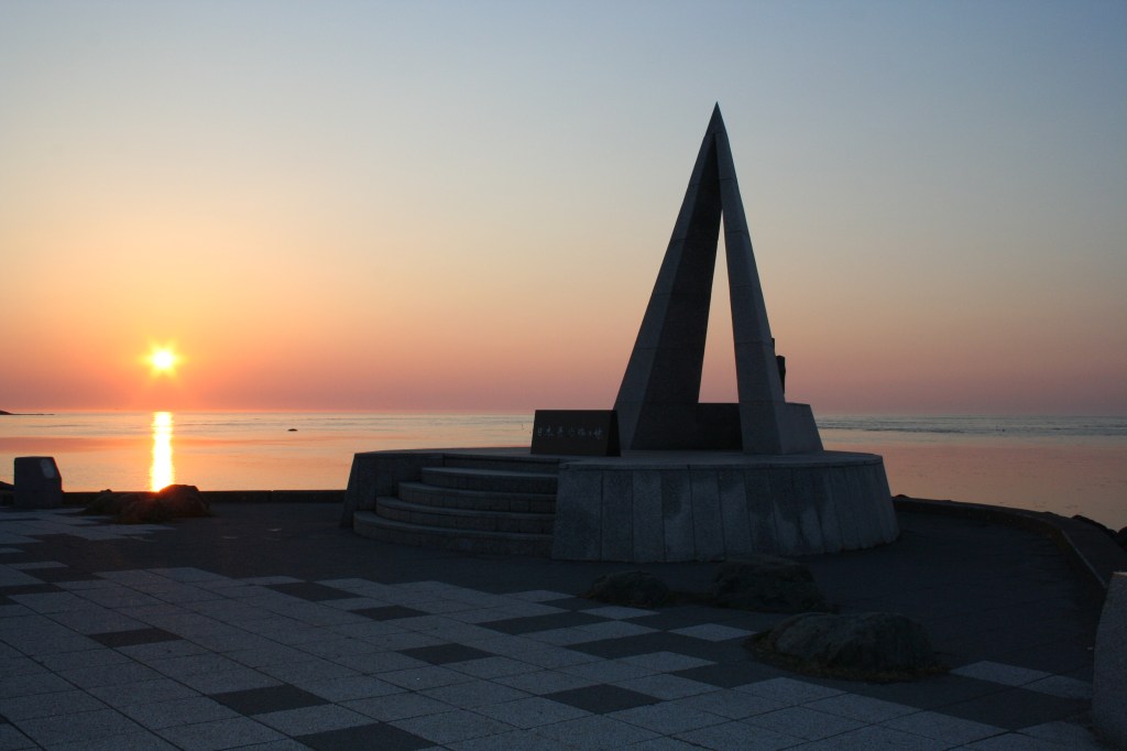
Cape Soya is the end of the road in northern Hokkaido: a low, wind-scoured headland at 45 degrees 31 minutes north, with the Sea of Japan on one side, the Sea of Okhotsk on the other, and the Russian island of Sakhalin faint on the horizon about 43 kilometres away. There is a monument, a lighthouse, a car park, a cluster of souvenir shops and not much else. And yet people cross Japan to stand there, take the same photograph that everyone takes, and look north.
The reason is not the facilities. It is the sense of an edge. Behind you are 3,000 kilometres of Japanese islands; in front is open water, an international strait, and another country. On a clear day the landmass of Sakhalin is visible as a grey line; in winter, drift ice can fill the sea; in summer, fog swallows everything and the lighthouse starts to moan. The cape is one of the few places in Japan where geography feels like an event.
It is also easy to visit badly. The bus from Wakkanai runs only a handful of times a day, the wind can make a summer afternoon feel like November, the famous White Road is closed for half the year, and the cape’s wartime and postwar memorials are easy to miss if you walk straight to the monument and back. This guide covers the 2026 transport details, the exact state of the park and the Soya Hills, the history behind the monuments, and how to build a half day or a full day around the northern tip of Japan. Fares, times and opening dates were checked in October 2026 and should be reconfirmed before you travel.
Where Cape Soya is, and what “northernmost” means
Cape Soya sits at the tip of the Soya Peninsula, the northern extremity of Wakkanai City. The city itself is Japan’s northernmost city, and the cape is the northernmost point of Hokkaido. The official phrasing on the monument is careful: this is the northernmost place in Japan that can be reached by ordinary transport. The country’s official northern limit includes islands in the Northern Territories that cannot be reached from Hokkaido, and the northernmost inhabited island is Rebun, just across the water. Cape Soya is therefore not a technical curiosity but a practical one: the last place you can drive or take a bus to, look north, and come back the same day.
The cape is not a dramatic cliff. It is a broad, grassy platform about 20 to 30 metres above the sea, with a rocky shore below and a line of low hills behind. The land rises gently to the Soya Hills, a sweep of pasture and wind turbines that is one of the most distinctive landscapes in Hokkaido. The whole peninsula is thinly populated: Wakkanai has roughly 30,000 people, and beyond the city the villages thin out into fishing ports and dairy farms.
Two seas meet here, or rather pass each other. The Soya Strait, also called the La Pérouse Strait, connects the Sea of Japan to the Sea of Okhotsk and separates Hokkaido from Sakhalin. It is about 43 kilometres wide at its narrowest point and relatively shallow, which is why drift ice can pour through it in winter and why the water is such a vivid blue-green in summer. The strait is an international waterway, busy with Russian and Japanese cargo ships, fishing boats and the occasional patrol vessel. From the cape you can watch them move across the horizon without any sense of a border, which is part of the point.
The monument and the park
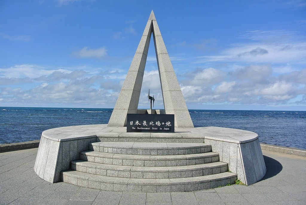
The monument is a slender triangular obelisk, 4.53 metres tall, designed as one ray of the North Star. The letter N on its face stands for north; the circular base represents peace and harmony. It marks 45 degrees 31 minutes 22 seconds north, and it is the thing everyone photographs. What most visitors do not know is that it is the second monument on the site. Local history enthusiasts put up a simple stone pillar in 1961, and the present monument was built on 10 July 1968. In 1988 the shoreline was reclaimed to create the car park and the plaza, and the monument was moved about 20 metres offshore to stand at the new northern edge. The latitude on the inscription rose by one second in the process.
The surrounding Cape Soya Park opened on 15 December 1966 with an area of about 3.8 hectares. It has since grown to 4.38 hectares and accumulated a surprising number of monuments for such an exposed piece of grass. Near the obelisk are a statue of Mamiya Rinzo, the surveyor who sailed from Soya to Sakhalin in 1808 and established that Sakhalin was an island; a music monument carved with the lyrics and score of the song “Cape Soya”; and a statue called Akebono, erected in 1971 to mark Hokkaido’s milk production. On the high ground behind the cape stands the Prayer Tower, the park’s tallest structure, and around it are a literary monument to Kenji Miyazawa, a monument to the French explorer La Pérouse, and two peace bells. The park is free, open all year, and has a free car park with 72 spaces.
The car park is the practical centre of the cape. It has toilets, a bus stop, several shops and restaurants, and a short paved path to the monument. The shops sell the usual Hokkaido souvenirs, dairy products, and a great deal of merchandise branded with the word “northernmost”. The cape is also home to Japan’s northernmost post office and police box, both a short walk from the park, which has become a small hobby for travellers who collect extremes.
A short history of the strait
Long before the monument, this was Ainu land. The Ainu lived across southern Sakhalin, Hokkaido and the Kuril chain, and the Soya Strait was a route rather than a border. Japanese involvement began in earnest in 1685, when the Matsumae clan established a trading post at Soya, and for the next two centuries the cape was a frontier station for trade, fishing and exploration. The name Soya comes from Ainu, although the etymology is debated.
In 1787 the French explorer Jean-François de La Pérouse sailed through the strait and named it after himself. The Japanese knew it as the Soya Strait, and the two names coexist today. La Pérouse’s voyage was one of the last great scientific expeditions of the pre-revolutionary French navy; he sent his charts home from Kamchatka and then vanished in the Pacific, and the account of his voyage became a European bestseller. A monument to him was added to the park in 2007, 220 years after he passed through.
The more consequential figure here is Mamiya Rinzo. In 1808, working for the Tokugawa shogunate, he crossed from Soya to Sakhalin, travelled its length, and returned to report that it was an island separated from the Asian mainland by a narrow strait. That channel is now called the Mamiya Strait. His survey was a remarkable piece of cartography in a region that both Japan and Russia were beginning to covet, and it made Soya a place of strategic as well as geographical significance. The statue in the park, erected in 1980 and moved to its present spot in 1988, shows him in travel clothes, looking north.
The twentieth century hardened the border. After the Russo-Japanese War, Japan took control of southern Sakhalin and developed Wakkanai as the gateway to it; the railway reached the town in 1928, and ferries carried passengers and freight to Otomari, now Korsakov. The old navy watchtower at the cape was built in 1902, before that war, when relations with Russia were deteriorating. During the Second World War the strait became a front line in the war at sea, and after 1945 the Soviet Union took the whole of Sakhalin and the Kuril Islands, turning the water north of the cape into a closed and militarised border. The Cold War made Wakkanai a remote outpost again, and the cape a place where people looked at a country they could not visit.
That history explains the density of memorials. The cape is not only a scenic viewpoint; it is a place where Japan remembers the sea and the people who died on it. The 1983 shooting down of Korean Air Lines flight 007, the sinking of the American submarine USS Wahoo in 1943, and the loss of Japanese ships in the same waters are all commemorated within a few minutes’ walk of the monument.
The old navy watchtower
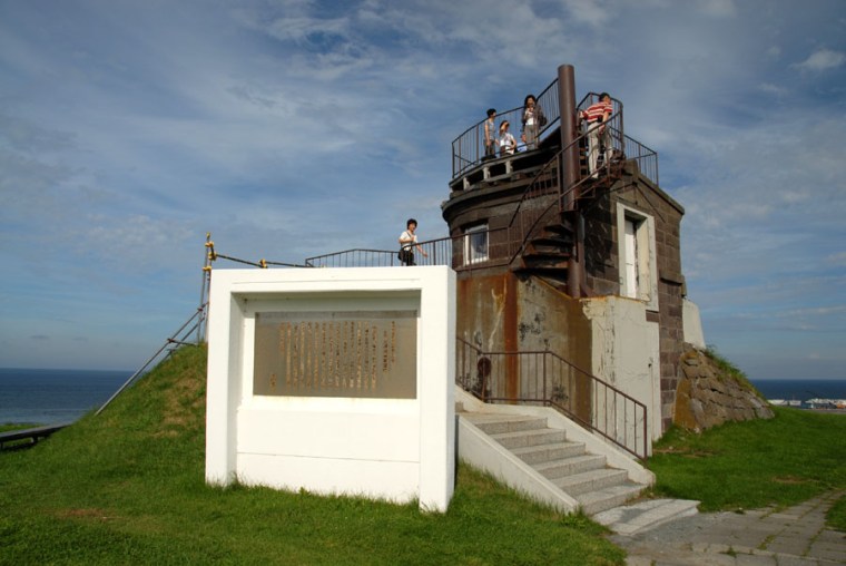
The watchtower stands on the low hill just west of the monument, a small, solid, square building with a viewing platform on top. It was built by the Imperial Japanese Navy in 1902 as a lookout over the strait, and a wireless station was added when the Russo-Japanese War began in 1904. From here the navy monitored Russian fleet movements through the strait until 1929. It is the only surviving Meiji-era building in Wakkanai and was designated a city tangible cultural property in December 1968. You can climb the external steps and look out over the water, though there is no exhibition inside and the structure is not staffed.
Next to it stands the Soya Sea Area Naval War Dead Memorial, erected in 1980 for sailors who died defending the region, including Sakhalin. The inscription carries the familiar Japanese pledge never to repeat war. A short walk away is the Peace Monument, erected jointly by Japanese and American groups in September 1995, fifty years after the end of the war. It commemorates the 80 crew of USS Wahoo, sunk in the strait in October 1943, and the crews of the five Japanese merchant ships that the submarine sank. It was the first jointly built Japanese-American memorial of its kind in Japan, and it is a quietly extraordinary thing to find at the edge of the country.
The Prayer Tower and the KAL 007 memorial
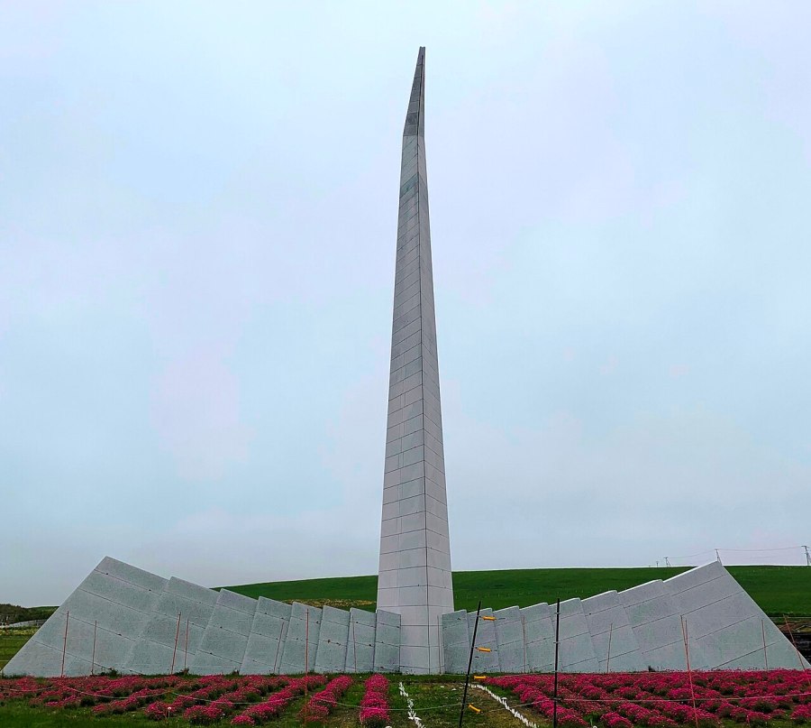
The Prayer Tower is the tallest thing in the park, a 19.83-metre abstract sculpture of a crane with its wings spread and its neck raised. It was completed on 1 September 1985, two years after Korean Air Lines flight 007 was shot down by a Soviet fighter near Moneron Island, west of Sakhalin. All 269 people on board died, including 28 Japanese. Wakkanai, as the Japanese city closest to the crash site, became the forward base for the search and for the families who came to wait for news.
The tower encodes the event in its dimensions. Its height, 19.83 metres, stands for 1983. Its 16 feathers represent the 16 nationalities of the victims, and the 269 stone panels on its surface represent the 269 dead. The beak points toward Moneron Island, and the angle of the sculpture matches the latitude of the crash site, 46 degrees 30 minutes. Around the base, armeria flowers are planted and bloom in early summer. The tower is visible from much of the park, and on a clear day the sea behind it looks impossibly calm for the story it marks.
The lighthouse
The Cape Soya Lighthouse stands on the high ground east of the monument, a white tower with two red horizontal bands, 17 metres tall and 39.8 metres above the water. It is the northernmost lighthouse managed by the Japanese government and one of the 50 lighthouses selected as representative of the country. The first light was lit on 25 September 1885, making it the third oldest lighthouse in Hokkaido after Nosappu and Hinode. The original octagonal iron tower burned down in a wildfire in May 1911; the replacement was lit in October 1912 and rebuilt in its present concrete form in 1954. Its light reaches about 32 kilometres and flashes four times every 30 seconds.
The lighthouse is not normally open to visitors. Once a year, usually in summer, the Wakkanai Coast Guard opens it to the public for a day, and the queue is long. The rest of the time you can walk up to the fence and look at it against the sea, which is enough. At dusk in winter the beam is visible from the car park, sweeping across the water toward Sakhalin.
Soya Hills and the White Road
Behind the cape, the land opens into the Soya Hills, a rolling plateau of pasture, low ridges and wind turbines. The landscape is a periglacial landform, shaped by freeze-thaw processes at the end of the last ice age about 10,000 years ago. The result is a pattern of gentle ridges, shallow hollows and sorted stones that looks simple from a distance and is unusual up close. In October 2004 the area was designated a Hokkaido Heritage site, and it is one of the best places in Japan to understand what a cold, windy, unglaciated landscape looks like.
The hills are working farmland. Dairy farms and beef cattle pastures cover most of the plateau, and the roads are narrow, unfenced and shared with tractors. This is not a place to wander off the road: the grass is crop, the cattle are valuable, and the ground can be soft. The official guidance is blunt about staying out of the pastures, and it is worth taking seriously.
The White Road
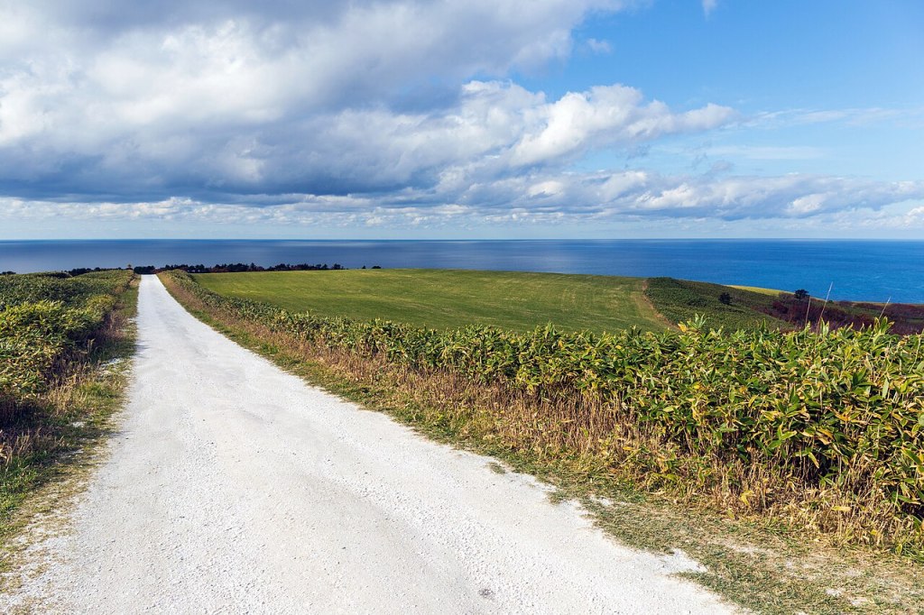
The White Road, or Shiroi Michi, is a three-kilometre farm road surfaced with crushed scallop shells, running across the hills toward the Sea of Okhotsk. The shells are a by-product of Wakkanai’s scallop industry, and they give the road a pale, almost chalky surface that contrasts with the green pasture and the blue water. It has become one of the most photographed roads in Hokkaido, and on a summer morning the car park at the start can be full of rental cars and cyclists.
The road is open only in the snow-free season. In 2026 it reopened on 24 April and normally closes in mid-November, with the exact dates depending on snow and road conditions. It is a narrow, single-lane farm road with passing places, not a highway. The official requests are simple: enter from the Cape Soya end, use the toilets at the cape before you start, drive slowly and yield to other vehicles, never enter the pastures, and slow down when you reach the Soya district at the far end.
There is an extra complication in 2026. The Eurus Soya Misaki Wind Farm, whose 57 one-megawatt turbines have been part of the landscape since 2005, ended operation in April 2026. Removal work began in May, and the operator plans to replace the turbines with 14 larger 4.3-megawatt machines, with operation targeted for 2030. During the work, from May to around October 2026, there are temporary traffic restrictions on the White Road and parts of the Soya Hills footpath, including weekday one-lane closures on the approach road from 08:00 to 17:00, with waits of five to ten minutes. Check the city’s road restriction page and the operator’s notice before you drive out, and allow extra time.
The Soya Hills viewpoint
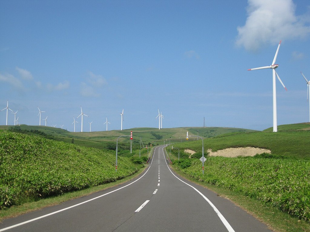
On the hill above the cape stands the Soya Hills observation and rest facility, a windmill-shaped building with a free observation deck on the second floor. It is open from 29 April to 3 November, from 09:00 to 17:00, and until 19:00 from June to September. The deck looks over the pasture, the strait and, on a clear day, the shadow of Sakhalin. The adjoining restaurant, Almelia, serves Soya black beef and local dishes, though the beef menu is a summer offering and hours can be shortened. Soya black cattle graze the surrounding pastures from May to October, which is why the fences matter.
The facility is a 15-minute walk from the Oomisaki bus stop, or a short drive from the cape. It is the best place to eat a proper meal near the cape outside the small shops at the monument, and the view from the deck is arguably better than the view from the monument itself because you can see the shape of the whole peninsula.
The view: Sakhalin, Rishiri, Rebun and drift ice
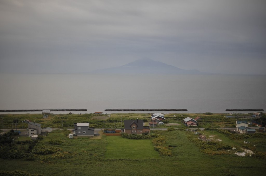
On a clear day the view north is the main event. Sakhalin lies about 43 kilometres away, a low grey outline that is easy to mistake for cloud until you notice it does not move. The island is Russian territory and cannot be visited from here, but seeing it changes the way the map feels. To the west, on a good day, the conical shape of Mount Rishiri rises out of the Sea of Japan; to the northwest, the long low profile of Rebun. Rebun is Japan’s northernmost inhabited island, and Rishiri lies just south of it; both are reached by ferry from Wakkanai.
The light is best in the early morning and late afternoon. In summer the sun sets far to the northwest, roughly behind Rishiri, and the sea turns copper. In winter the sun is low all day and the air is often clearer than in summer, when warm, moist air from the south produces fog. The cape is famous for its sunsets, and the hero image on this guide is one of them: a quiet evening with the sea flat and the sky doing most of the work.
Winter brings drift ice. The Okhotsk ice field forms off the Siberian coast, travels south over about six weeks, and reaches the northern Hokkaido coast in late January or February. At Wakkanai the average first day on which ice is visible from the coast is 19 February, and the average last day is 4 March, though the range is wide: in some years there is no ice at all, and in others it lingers into April. In 2026, ice flowed into the Soya Strait in late January and again in mid-February, and some of it reached the cape. When it is present, the sea turns into a white, shifting plain, and the view from the monument becomes something else entirely. It is never guaranteed, so treat it as a bonus rather than a plan.
Weather and seasons
Wakkanai has a cool, windy maritime climate. The Japan Meteorological Agency’s 1991-2020 normals give an annual mean temperature of 7.0 degrees Celsius, with August averaging 19.5 degrees and January minus 4.3 degrees. The annual mean wind speed is 4.6 metres per second, and the cape is more exposed than the city. Snowfall is heavy: the city averages 477 centimetres of snow a year and a maximum depth of 72 centimetres, with the deepest snow in February. Summer is short, cool and often foggy; winter is long, grey and windy, with snow from December to March.
That means the cape is a place to dress for the weather rather than the season. A sunny August day can be 20 degrees in Wakkanai and 14 degrees at the cape with a 30-kilometre-per-hour wind. A clear January day can be beautiful and painfully cold. Rain gear is useful in every month, and a windproof outer layer is essential even in midsummer. The wind is not a nuisance here; it is the defining feature of the place, and the landscape of turbines, bare pasture and low houses is shaped by it.
The best months for a first visit are June, July, September and early October. June has wildflowers and long daylight; July and August are warmest but foggy; September and October are clear, cool and relatively dry, with the pasture turning gold. Late April and May are good for the White Road and the start of the tourist season, but snow can linger on the hills. Winter is for drift ice, sunsets and empty roads, with the caveat that some facilities close and driving can be difficult.
Getting to Wakkanai
Wakkanai is remote even by Hokkaido standards, and the journey is part of the trip. By air, ANA flies from Tokyo Haneda to Wakkanai in about 1 hour 55 minutes, with one year-round flight and a second seasonal flight in summer, and from New Chitose Airport near Sapporo in about 55 minutes. The airport is about 30 minutes from Wakkanai Station by bus; the bus is timed to flights, costs 800 yen for adults and 400 yen for children, and accepts cash or PayPay only. It does not connect with the ferries, so leave a buffer if you are heading to Rishiri or Rebun.
By train, the limited express Soya runs once a day between Sapporo and Wakkanai in about 5 hours 10 minutes, leaving Sapporo in the morning and returning in the late afternoon. From Asahikawa, the limited express Sarobetsu takes about 3 hours 45 minutes to Wakkanai, with two round trips a day, though some services are cancelled on certain weekdays in the quiet season. The train ride across the Sarobetsu Plain and through the Soya hills is slow and beautiful, and the station itself is the northernmost railway station in Japan.
By car, Wakkanai is about 5 hours 40 minutes from Sapporo and about 4 hours 50 minutes from Asahikawa via the Soya and Asahikawa roads. The drive north from Asahikawa crosses the Sarobetsu Plain and then follows the coast, and it is one of the great road trips of Hokkaido. Rental cars are available in Wakkanai, but the number is limited and they sell out in summer; book ahead. Fuel up in the city before heading to the cape, because the options thin out quickly.
Getting from Wakkanai to Cape Soya
The Soya Bus Tenpoku Soya Misaki Line runs from Wakkanai Station bus terminal, stand 1, to the cape. The outbound journey takes about 50 minutes and the return about an hour, and the adult fare is 1,600 yen one way, or 800 yen for children. A round-trip commemorative ticket costs 2,880 yen and is sold at the station terminal. The caveat is frequency: there are only a handful of buses a day, and missing the last one is not a trivial matter. Check the current timetable on the Soya Bus website and plan your return before you leave in the morning.
The bus stop at the cape is not the terminus; the bus continues to Hamatonbetsu or Onishibetsu. Tell the driver you are getting off at Soya Misaki, and wait inside the shelter until the bus is close on the return, because the driver may not see you if you wait indoors. The stop is a short walk from the monument and the car park.
By car, the cape is about 40 minutes from Wakkanai Station and 25 to 30 minutes from the airport, following Route 238 north. The road is paved and easy, but exposed to crosswinds, and in winter it can be snow-covered or closed. The car park at the cape is free and has 72 spaces; it fills in summer and on weekends, but turnover is fast. There is no petrol station at the cape that you should rely on, so fill up in Wakkanai.
A taxi from Wakkanai is possible but expensive, and the driver may not want to wait. If you want a flexible half day without a car, the practical options are the bus, a rental car, or a guided tour from Wakkanai. Cycling to the cape is possible for strong riders, but the distance is about 30 kilometres each way and the wind can be brutal; it is not a casual ride.
Around the cape on foot
The core of the cape is compact and walkable. From the car park, the monument is two minutes away, the lighthouse five minutes, the old watchtower five minutes in the other direction, and the Prayer Tower a few minutes up the slope. The paths are paved or gravel, with some steps and short gradients. The wind is the main obstacle: on a bad day it can be hard to stand upright at the monument, and sand and spray blow across the car park. There is little shelter apart from the shops and the toilets.
Wheelchair users and travellers with limited mobility can reach the monument and the main viewpoints via the paved paths, but the slopes to the Prayer Tower and the lighthouse are steeper and the surfaces are uneven in places. The car park has accessible parking and toilets. The Soya Hills observation facility has accessible toilets, and the White Road is a road rather than a trail, so it can be experienced by car.
Allow at least an hour at the cape itself, two if you want the monuments, the watchtower, the lighthouse and a meal. The park is free and has no gate, so you can arrive at sunrise or stay for sunset as long as you have transport. Sunset in summer is around 19:20 in late June and 16:00 in December, so the last bus is the real limit on a day trip.
A half day at the cape
Take a morning bus from Wakkanai Station and walk first to the monument while the light is still low and the car park is quiet. Then follow the path west to the old navy watchtower and the Peace Monument, and climb the slope to the Prayer Tower for the view over the strait. Spend 20 minutes in the shops, buy a coffee, and walk to the lighthouse. If the weather is clear, the view of Sakhalin from the high ground behind the monument is the best in the park.
For lunch, either eat at one of the cape restaurants or take the local bus or a short taxi ride to the Soya Hills observation facility, where the restaurant serves Soya black beef in summer and the deck looks over the whole peninsula. Return to the cape for the afternoon bus, or, if you have a car, drive the White Road in the late afternoon when the light is best. The last bus back to Wakkanai leaves in the late afternoon, so check the timetable and do not cut it fine.
A full day: cape, hills and Wakkanai
With a car, start early and drive north along the coast, stopping at the fishing villages and the viewpoints on Route 238. Reach the cape by 08:30, before the tour buses, and do the monument, watchtower, Prayer Tower and lighthouse in that order. Drive up to the Soya Hills observation facility for the view and an early lunch, then take the White Road south across the hills, respecting the one-lane sections and the farm traffic. In the afternoon, return to Wakkanai and visit the North Breakwater Dome, the city’s most distinctive building, and the Noshappu Cape on the western side of town.
The Breakwater Dome was built between 1931 and 1936 to protect the port from waves and wind. It is 427 metres long, 13.6 metres high, with 70 columns supporting a half-arch corridor that looks like a fragment of ancient Rome dropped into a northern fishing town. It was designated a Hokkaido Heritage site in 2001 and celebrated its 90th anniversary in 2026. It is free, open, and particularly good at sunset, when the light comes through the arches.
Noshappu Cape is about 15 to 20 minutes from Wakkanai Station by bus, with buses every 15 to 20 minutes and a fare of 250 yen. It has a lighthouse, a monument to the local fishing industry, and the Noshappu Cold Water Aquarium, which is small but excellent for cold-water species. The aquarium is open from 09:00 to 17:00 in summer and 10:00 to 16:00 in winter, closed from 1 April to 28 April and from 1 December to 31 January, and admission is 500 yen for adults and 100 yen for children. From the cape you can see Rishiri and Rebun on a clear day, and the sunset over the Sea of Japan is one of the best in Hokkaido.
Finish the day with seafood in Wakkanai. The city’s harbour lands scallops, crab, salmon, sea urchin and octopus, and the restaurants around the station and the ferry terminal serve them without much ceremony. Wakkanai ramen is a local style with a salt base and seafood stock, and Soya black beef is the other local specialty. Kitacolor, the shopping centre next to the station, has a food hall and souvenir shops if you are leaving on an evening train.
Combining the cape with Rishiri and Rebun
Cape Soya is the gateway to the two northern islands, and many travellers combine all three. Heart Land Ferry runs from Wakkanai Port to Oshidomari on Rishiri in about 1 hour 40 minutes and to Kafuka on Rebun in about 1 hour 55 minutes. In 2026 the economy fare is 2,990 yen one way to Rishiri and 3,290 yen to Rebun. The number of sailings varies by season, from two a day in winter to three in late April, May and October, with the first departure from Wakkanai between 06:30 and 07:15 depending on the month. The ferry terminal is a five-minute walk from Wakkanai Station.
Rishiri is a round island dominated by Mount Rishiri, a dormant volcano that rises straight out of the sea. It is a place for hiking, cycling and quiet fishing ports, and the loop road takes about two hours by car. Rebun is longer and narrower, famous for alpine flowers that bloom from late May to August, and for the walking trail along its western coast. Both islands have small inns, campsites and seafood restaurants, and both are quiet outside the brief summer season.
The practical sequence is to spend a night in Wakkanai, take an early ferry to one island, stay overnight, and return the next day; or to visit the cape on the arrival day and take the ferry the following morning. Do not try to do the cape and an island in one day. The ferries are not timed for it, the weather can cancel sailings, and the islands deserve more than a few hours.
Food and drink
At the cape, the options are limited to the shops and restaurants around the car park. They serve ramen, seafood bowls, curry, ice cream and coffee, with hours that shrink outside summer. Do not arrive expecting a late dinner. The Soya Hills observation facility is the best sit-down meal near the cape, with Soya black beef, local vegetables and dairy desserts in season; it closes in early November and the beef menu is summer-only.
In Wakkanai, the eating is much better. The harbour area and the streets around the station have sushi restaurants, seafood izakayas and ramen shops, and the local scallops are sweet and firm. Look for hotate (scallops), taraba crab in winter, uni in summer, and salmon in autumn. Soya black beef is a premium local beef with fine marbling; it appears on menus around the city and at the Soya Hills restaurant. For a quick meal, Kitacolor has several options, and the ferry terminal has a cafe with a view of the port.
Cash is useful at the cape’s smaller shops, though the larger ones accept cards and IC payment. The bus accepts cash and some IC cards, but not every card; the airport bus takes cash or PayPay only. Carry a few thousand yen in cash for the cape and the buses, and do not count on finding an ATM north of Wakkanai.
Where to stay
There is no accommodation at Cape Soya. The nearest hotels are in Wakkanai, 40 to 50 minutes away, and that is where most visitors base themselves. The largest cluster is around Wakkanai Station and the ferry terminal, which is convenient for both the cape bus and the islands. Surfeel Hotel Wakkanai is the biggest full-service hotel, close to the ferry terminal and the Breakwater Dome; Dormy Inn Wakkanai is a reliable mid-range option with a natural hot spring bath; and there are several smaller business hotels and guesthouses around the station.
On Rishiri and Rebun, the choice is small inns, minshuku and campsites, with a few larger hotels near the ports. Book ahead in summer, when Japanese hikers and flower viewers fill the islands, and confirm whether your inn offers meals, because restaurant options are limited in the evenings. In winter, many island facilities close, and the ferries can be cancelled for days at a time.
Photography
The classic shot is the monument against the sea, taken from the paved path with the lighthouse in the background. It works at any time of day, but the light is best in the early morning and late afternoon. In summer the sun sets to the northwest, behind Rishiri, and the monument becomes a silhouette; in winter the low sun rakes across the grass and the sea turns silver. The Prayer Tower is best photographed from the path below, with the tower against the sky, and the old watchtower is a good subject in fog.
For the landscape, the Soya Hills observation deck gives the broadest view, and the White Road is best in the early morning before the rental cars arrive. The road runs toward the sea, so a wide lens and a low angle work well; do not stand in the middle of the road for a shot, because it is a working farm road and vehicles come around the bends quickly. A telephoto lens is useful for Sakhalin, Rishiri and the ships in the strait, and for the drift ice in winter.
Drones are tempting here, but the cape is close to a lighthouse, a busy strait and a national border, and local rules are strict. Do not fly without checking with the Wakkanai city office and the relevant aviation authorities, and never fly over the monument crowds or the pastures. A tripod is fine on the paths but not inside the shops or the observation facility.
Practical tips, wind and winter driving
The wind is the thing to prepare for. A windproof jacket, a warm mid-layer, gloves and a hat are sensible even in July. An umbrella is useless in the stronger gusts; bring a hooded raincoat instead. In winter, add insulated boots with grip, because the car park and the paths can be icy, and protect your camera from salt spray.
Driving to the cape is straightforward in summer and serious in winter. Route 238 is cleared, but snow can fall from November to April, the wind creates drifts, and the road can be closed with little notice. Check the Wakkanai city road closure page and the Hokkaido road information before you set out. If you are not used to driving in snow, take the bus in winter. The cape’s car park is ploughed, but the paths may not be, and the monument can be surrounded by ice.
The bus is the safest option for a winter day trip, but remember that the last bus leaves in the afternoon and that the cape has no indoor waiting area apart from the shops. The shops close early in winter, so carry food and water. The Soya Hills observation facility is closed from 4 November to 28 April, and the White Road is closed from mid-November to late April.
Responsible travel at the cape
The cape is a memorial landscape as well as a scenic one. Keep your voice down around the Prayer Tower and the war memorials, and do not climb on the monuments. The old watchtower is a cultural property; use the steps and do not force doors. The lighthouse is a working navigational aid, and the fence is there for a reason.
The Soya Hills are private farmland. Stay on the road, do not enter the pastures, do not approach the cattle, and do not park in field entrances. The White Road is a farm road, not a race track; slow down for tractors, cyclists and walkers, and give way on the single-lane sections. Carry your rubbish back to Wakkanai, because bins at the cape are limited and the wind takes anything loose.
Treat the border with respect. Sakhalin is visible but not accessible from here, and the strait is patrolled. Do not fly drones toward the Russian coast, do not photograph military installations, and do not attempt to approach the water’s edge beyond the marked paths. The cape is a place where geography and politics meet, and the atmosphere is calmer if you remember that.
Before you go
- Check the Soya Bus timetable for your date; there are only a few buses a day and the last one leaves in the afternoon.
- Buy the 2,880 yen round-trip ticket at Wakkanai Station if you are going by bus.
- Confirm the White Road is open (late April to mid-November) and check the 2026 wind farm traffic restrictions.
- Check the Soya Hills observation facility dates: 29 April to 3 November, 09:00 to 17:00, until 19:00 in summer.
- Bring a windproof layer, warm clothes and rain gear, even in August.
- Fill up with fuel in Wakkanai and carry cash for small shops and buses.
- In winter, check road closures and drift ice conditions before setting out.
- If you are continuing to Rishiri or Rebun, book the ferry and accommodation ahead and leave a weather buffer.
- Reconfirm hours, fares and closures on the official pages below before travelling.
Sources
- Wakkanai City: Cape Soya Park (checked 2026-10-26)
- Wakkanai City: the White Road (checked 2026-10-26)
- Wakkanai City: current road restrictions, including the White Road (checked 2026-10-26)
- Soya Bus: access to Cape Soya, times and fares (checked 2026-10-26)
- Soya Bus: Wakkanai airport shuttle (checked 2026-10-26)
- Heart Land Ferry: 2026 Wakkanai-Rishiri-Rebun timetable (checked 2026-10-26)
- Heart Land Ferry: 2026 fares (checked 2026-10-26)
- Japan Meteorological Agency: Wakkanai climate normals 1991-2020 (checked 2026-10-26)
- Japan Meteorological Agency: Wakkanai drift ice records (checked 2026-10-26)
- Wakkanai City: access by rail and air (checked 2026-10-26)
- Wakkanai City: Soya Hills observation facility (checked 2026-10-26)
- Wakkanai City: Noshappu Cold Water Aquarium (checked 2026-10-26)
- Wakkanai City: North Breakwater Dome (checked 2026-10-26)
- Eurus Energy: Soya Misaki wind farm removal, May 2026 (checked 2026-10-26)
- Wakkanai Brand: Cape Soya and Soya Hills (checked 2026-10-26)
Related guides
- Rebun Island Travel Guide — alpine flowers and the northern coast
- Abashiri Drift Ice Travel Guide — the Okhotsk ice season
- Asahikawa Travel Guide — the gateway to northern Hokkaido
- Shiretoko Travel Guide — the wild east of Hokkaido
- Sapporo Travel Guide — the city at the start of the northern journey


Leave a Reply