Planning Rishiri in Hokkaido? This English guide covers the climb, the ponds, the coast and the ferry from Wakkanai.
Operational details such as opening hours, admission fees, and train times can change. Prefer official pages and reconfirm before you travel (sources checked on 05 November 2026).
Why visit
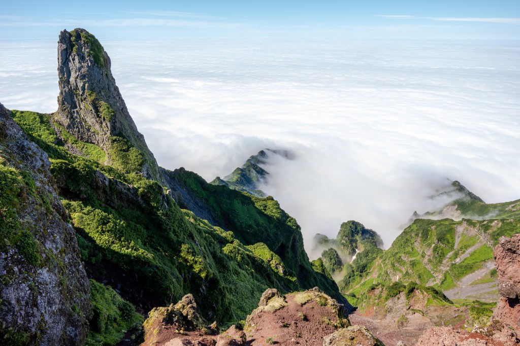
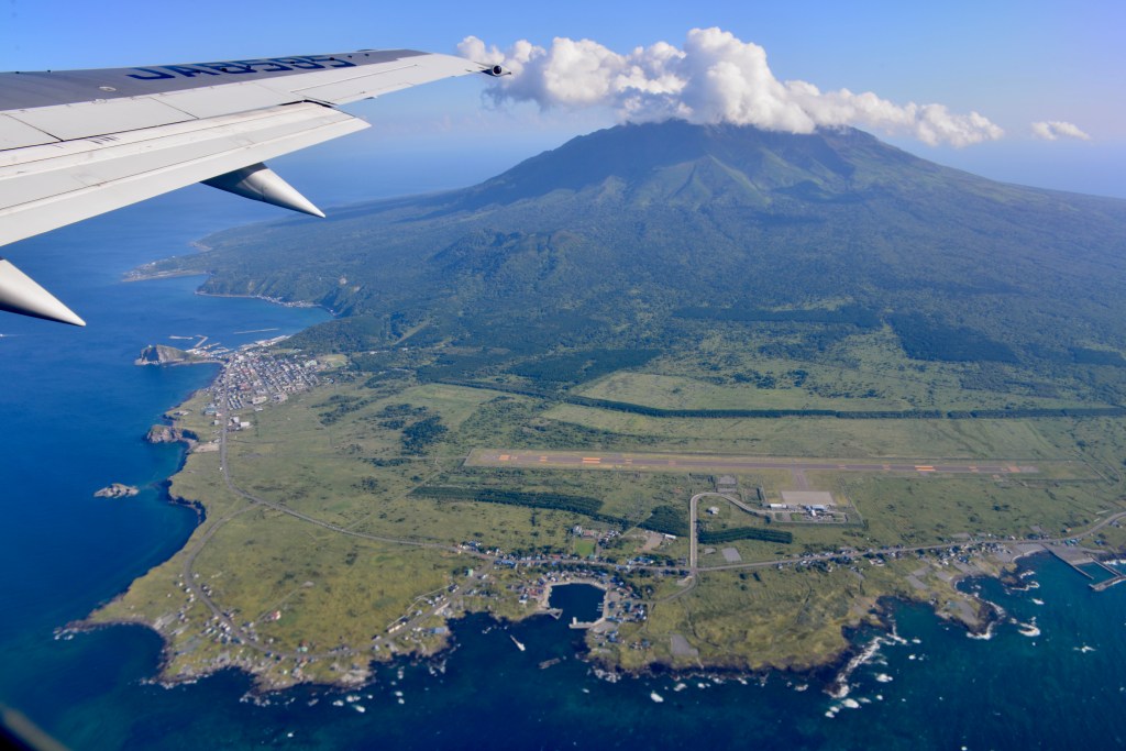
- Rishiri is a single volcano rising straight out of the Sea of Japan, 1,721 metres of it, with a small town wrapped around the base. From the ferry it looks like an island wearing a mountain rather than an island with a mountain on it.
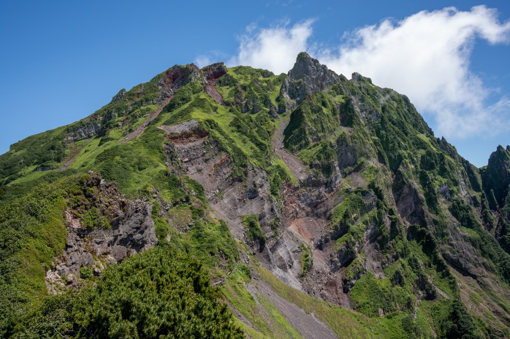
- The climbing season is short and the mountain is serious: a long, steep day with no water above the third station. That difficulty is exactly why the island feels different from the rest of Hokkaido’s easy sightseeing.
- Rishiri kombu is the highest grade of kelp in Japan, and the drying grounds, the cutting sheds and the shops selling it are part of the landscape rather than a tourist demonstration.
- The island has three of the north’s best small views: the reversed peak in Hime-numa on a still morning, the pond at Otatomari, and the sunset or sunrise from Cape Peshi above the ferry port.
- You can eat sea urchin that was in the water an hour earlier, cook your own scallops at a roadside stall, and drink spring water from the mountain at a tap by a campsite.
- It pairs naturally with Rebun, one island away on the same ferry line, and the two together make a week in the far north worthwhile.
- Renting a car is easy, distances are short, and the roads are quiet. There is almost no traffic, no queues and no need to book restaurants a month ahead, which is rare in Japan.
Top places and highlights
The ferry crossing from Wakkanai
The approach is part of the visit. The ferry from Wakkanai to Oshidomari takes about an hour and forty minutes, and for most of it the mountain grows in front of you until it fills the horizon. In summer the timetable has three sailings a day each way, with the first leaving Wakkanai in the early morning and the last in the late afternoon, and the pattern changes in spring, autumn and winter, so check the operator’s seasonal timetable rather than relying on a guidebook. Seagulls follow the boat and passengers feed them on deck. Sit on the port side going out for the best view of the peak. The terminal at Oshidomari is in the middle of the main settlement, with rental car counters, a shop and a bus stop, so you can be on the road within minutes of docking.
Climbing Rishiri from the Oshidomari trailhead
The main route starts at the Hokuroku campsite, about ten minutes by car or an hour on foot from the port, and runs 8.4 kilometres to the summit with roughly six hours of ascent and four and a half hours down. It is rated for intermediate walkers, which understates it: the upper section is steep, loose volcanic gravel, and people do turn back. There is no water above the third station, so carry everything you need. The trail is normally maintained in mid-June and again in late September, and that window is when the route is in its best condition; the first snow on the summit usually comes in early October. Register your plan at the campsite office, wash your boots to avoid carrying invasive species uphill, and note that camping is allowed at the trailhead campsite with a reservation and that a portable toilet is required on the mountain.
The Kutsugata route and the barrier season
The second route starts much higher, at the Mikaeri-dai enclosure on the Kutsugata side, reachable by car in about twenty-five minutes from Kutsugata town. From there it is around three hours up and two hours down, but the path only goes as far as Sankyozan; beyond that it is closed, which means this is a ridge walk and a viewpoint rather than a summit route. It is the option for a half day or for walkers who want altitude without committing to the full climb. Be aware of the seasonal barrier: from mid-October to early May the road to the trailhead is closed before the car park, so you cannot drive up in winter. In that period the mountain is a subject for photographs from the coast, not a place to walk.
Hime-numa and the reversed peak
Hime-numa is a small pond in the wooded northern part of the island, roughly a kilometre around, and it is famous for one thing: on a windless morning the mountain is reflected in the water almost perfectly. The walk around it takes about thirty minutes on a path through spruce and fir, with birdsong and no traffic noise. The pond is open from 1 May to 31 October and closed outside that period, with free parking for about fifteen cars and toilets on site. The small shop sells coffee made with spring water from the mountain. Come early, both for the stillness that makes the reflection and because tour groups arrive mid-morning. Even without the reflection, this is the calmest hour you will spend on the island, and the viewpoint on the road up gives you the harbour and Rebun beyond.
Otatomari-numa and the White Lover’s hill
Otatomari is the largest pond on the island, in the south-east, with a loop path of about 1.3 kilometres that is almost flat and open to the mountain across the water. It has the most developed facilities on the island: free parking for around twenty-nine cars, toilets, and a restaurant serving grilled scallops, soft-serve ice cream and local seafood. The pond opens from 1 May to 31 October with the same seasonal closure as Hime-numa. A short walk away is Numaura viewpoint, known as the hill of the White Lover’s chocolate, because the view of the mountain from that spot is said to be the one used on the packaging. Whether or not you care about the confectionery, it is a good five minutes of walking and a better angle than the car park.
Kanro spring water at the third station
About ten to fifteen minutes up the Oshidomari trail from the campsite, at roughly the third station, a spring comes out of the hillside and is channelled into a tap and basin. It is one of the hundred famous waters of Japan and the northernmost on that list, and islanders come up to fill containers. The water is soft and faintly sweet, and it is the last reliable source on the way to the summit. You do not need to be climbing to visit: park at the campsite, walk up through the forest, fill a bottle and turn around. The campsite shop sells coffee made with the same water. The path is a mountain trail rather than a pavement, so wear proper shoes even for this short walk.
Kamiiso Coast Park: splitting sea urchin and making kombu
Run by the Rishiri town tourism association on the coast at Kutsugata, this small park is where you handle the island’s produce rather than just eat it. The main activity is sea urchin: you split and open a purple urchin yourself and eat it on the spot, which is a better lesson in why the local uni commands the price it does than any restaurant menu. The park also runs kombu workshops where you make products from a whole sheet of Rishiri kelp, and a crab-fishing corner for children on the rocks with borrowed tackle. The season is 1 June to 30 September, from 9:30 to 16:30 with last entry at 16:00, and the urchin experience costs 2,000 yen for one urchin. There are eighteen parking spaces and a barrier-free toilet. May is available by reservation only, and prices and availability should be confirmed before you go.
Cape Peshi, Cape Kutsugata and the southern coast
Cape Peshi is a 93-metre rock headland immediately above Oshidomari port, about ten minutes on foot from the ferry terminal, with a twenty-minute climb to the viewpoint. There is no car park at the trailhead, so leave the vehicle at the terminal and walk. The view takes in the harbour, the mountain behind the town, Rebun across the strait and, on a clear day, the mainland. It is the island’s sunrise and sunset spot, and the path is steep enough that wet weather makes it slippery. At the other end of the island, Senboshi Misaki Park is the southern tip, where lava flows from the volcano formed black rocks along a very clear shoreline; you can see kelp and sea urchins from the surface, and in season there are seals in a pool with feeding at 100 yen a bag between 9:00 and 16:00. Parking is free, with about fourteen spaces and toilets.
Food and drink
- Sea urchin is the island’s signature. The purple urchin season centres on summer, and the cheapest honest way to eat it is to split one yourself at Kamiiso Coast Park for 2,000 yen.
- Rishiri kombu is the highest grade produced in Japan. Buy it dried, in dashi packs, or as shio-kombu, and remember that it is light and travels well.
- Scallops grilled at roadside stalls, particularly around Otatomari-numa, are the standard snack, along with soft-serve ice cream flavoured with local ingredients.
- Hokke and other fish from the surrounding water appear on menus in season, and the autumn catch is when the fish are fattest.
- Restaurants are few and close early. Many guesthouses serve dinner and breakfast as part of the room rate, and that is usually the most reliable meal on the island.
- There is a day-use hot spring in the Oshidomari area with a tap of the mountain’s spring water on site, which makes a good end to a day of walking.
Getting there and around
- Ferry from Wakkanai to Oshidomari takes about one hour forty minutes. In summer there are three departures a day each way, with a reduced timetable in the other seasons, so check the current schedule.
- Ferry from Wakkanai to Kutsugata on the west side serves the second town, useful if your accommodation is on that side.
- There are also direct ferry connections between Rishiri and Rebun in summer, which lets you combine the two islands without returning to Wakkanai.
- By air, Rishiri airport has year-round flights from Sapporo’s Okadama airport and seasonal flights from New Chitose in summer, which is the fastest option from central Hokkaido.
- On the island, use a rental car for the trailheads and the south coast; buses exist and a one-day pass is sold, but frequencies are low and change with the season.
- Rental cars, scooters and bicycles are limited in number on an island this small, so reserve before you arrive, particularly in July and August.
- For the Oshidomari trailhead, it is a ten-minute drive or an hour on foot from the port; for the Kutsugata trailhead, twenty-five minutes by car from the port.
Where to stay
- Accommodation is in small hotels, guesthouses and minshuku, concentrated around Oshidomari and Kutsugata, with several places offering dinner and breakfast.
- Book early for July and August and for the climbing season, when the island’s limited rooms fill with walkers and uni-season visitors.
- The trailhead campsite near the Oshidomari route has a small fee, requires a reservation for the cabins, and is the practical base if you intend to climb.
- One night is enough for the coast and the ponds; two nights if you want to climb, because the mountain takes a full day and the weather can take another.
Best time to visit
- June to August is the season for climbing and for the sea: the trail is clear of snow, the urchin fishery is active, and the island’s flowers and alpine plants are at their best.
- July and August are the warmest and busiest months, with the highest chance of calm seas for the crossing and the most reliable ferry and flight schedules.
- September is quieter and still climbable, with the trail maintained again late in the month and the first snow on the summit usually arriving in early October.
- From mid-October to early May the Kutsugata trailhead road is closed and the ponds close at the end of October. Winter visits are about the coast, the town and the mountain seen from sea level, not about walking up it.
Practical tips
- Check the ferry timetable by season rather than by memory; the summer pattern with three sailings a day is not the winter pattern.
- Book the rental car before you arrive. There are only a handful of operators and the trailheads are not walkable in a day.
- Carry water for the climb and treat the spring at the third station as the last supply point, not as a tap you can rely on later.
- Wash your boots at the campsite before starting up. Invasive species on alpine trails are a real problem on this island and the request is not decorative.
- Bring a portable toilet for the mountain and pack out everything. There are toilets at the trailhead but none above.
- Do not drive up to Cape Peshi expecting a car park; there is none at the trailhead, so use the ferry terminal car park and walk ten minutes.
- Watch the weather for wind, not just rain. The crossing is cancelled for swell and the exposed ridges are unpleasant in high wind even on a sunny day.
- Confirm opening dates for the ponds, the experience park and the trailheads before travelling; most of the island’s facilities run from May or June to the end of October.
Suggested day-trip outline
- Day 1, morning: take the first ferry from Wakkanai, arrive at Oshidomari, collect the rental car and drive up to Hime-numa for the reflection before the tour groups arrive.
- Day 1, midday: walk up to Kanro spring from the campsite for water and forest, then lunch in Oshidomari.
- Day 1, afternoon: the south coast, stopping at Otatomari-numa, the Numaura viewpoint and Senboshi Misaki Park for the lava shore and the seals.
- Day 1, evening: climb Cape Peshi for the sunset over the harbour, then dinner at the accommodation; check the next day’s forecast and ferry times.
- Day 2: either climb Rishiri from the Oshidomari trailhead, starting early and allowing ten hours, or drive the Kutsugata coast and do the urchin experience at Kamiiso Coast Park before the afternoon ferry.
Before you go
Timetables, fares, admission fees, and seasonal access rules can change. Check the official tourism and transport sites linked below for the latest information before you travel.
Explore More of Japan
Published guides that pair with this one:
- Rebun Island Travel Guide: Japan’s Northern Flower Island
- Cape Soya Travel Guide: Japan’s Northernmost Point
- Niseko Travel Guide: Ski Slopes, Summer Trails, and Mount Yotei
- Sapporo Travel Guide: Food, Parks, and a Hokkaido Base
Browse every Hokkaido guide on this site for the rest of the region.
Sources
- rishiri-plus.jp (checked 2026-11-05)
- rishiri-plus.jp (checked 2026-11-05)
- north-hokkaido.com (checked 2026-11-05)
- north-hokkaido.com (checked 2026-11-05)
- north-hokkaido.com (checked 2026-11-05)
- travel.willer.co.jp (checked 2026-11-05)


Leave a Reply