A practical English guide to Okutama in western Tokyo: Nippara limestone cave, Hatonosu gorge, the old road to Lake Okutama, hiking and train access from Shinjuku.
Operational details such as opening hours, admission fees, and train times can change. Prefer official pages and reconfirm before you travel (sources checked on 05 November 2026).
Why visit
- Okutama is the western edge of Tokyo, a mountain town of 225 square kilometres where 94 per cent of the land is forest and where the whole municipality sits inside Chichibu-Tama-Kai National Park. The Tama river runs through it, the ridges rise to Mount Kumotori at 2,017 metres, and the elevation range from the edge of Ome to the summit is about 1,800 metres, which is why the town has the only subalpine zone in Tokyo.
- It is also remarkably close. From Shinjuku it takes about two hours by train, changing at Tachikawa onto the Ome line, and from Tokyo station about two hours fifteen. That combination, real mountains and a commuter rail line, is why Okutama fills with hikers and campers at weekends and stays quiet on weekdays.
- There are three things worth building a day around. Nippara limestone cave is the largest in the Kanto region, a long passage of stalactites and stalagmites that has been a site of mountain ascetic practice since the Kamakura period and holds a constant 11 degrees inside. Hatonosu gorge is a short walk from a station, a deep channel of giant boulders and green water with a footbridge over it. And Lake Okutama, the reservoir behind the Ogouchi dam, supplies about a fifth of Tokyo’s water and has a walking route along its shore.
- What makes Okutama worth more than a hike is the old road. The Okutama mukashi-michi is the Edo-period highway that linked Edo with Koshu, running about nine kilometres from the station to the lake, past shrines, stone markers, roadside Buddhas and giant trees. Walking it in one direction and returning by bus is the best single day this area offers.
Top places and highlights
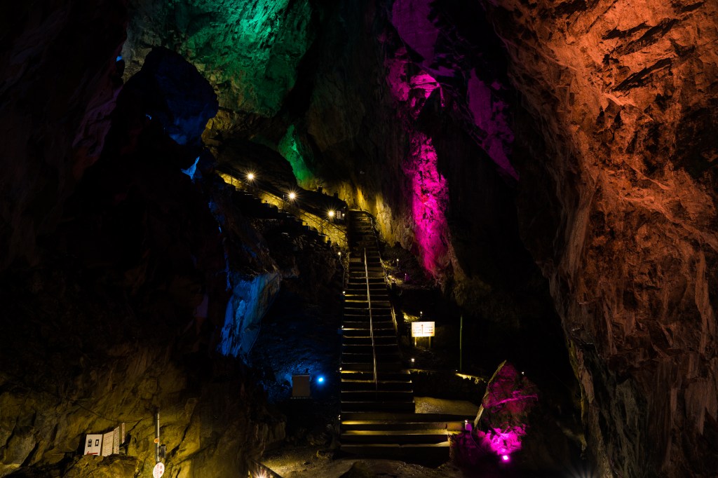
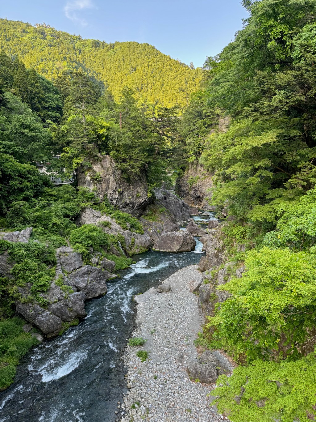
Nippara limestone cave
Nippara is the largest limestone cave in the Kanto region, a long, cool passage in the mountains west of Okutama station, and it has been a place of Shugendo practice since the Kamakura period. The formations are named after Buddhist figures, including a white-robed Kannon and a rock said to resemble a giant toad, and the effect of the lighting on the wet stone is more atmospheric than the size alone would suggest. The temperature inside is 11 degrees all year, which makes it a refuge in summer and a cold place in winter. Stalactites grow about one centimetre every 70 years and stalagmites about one centimetre every 130, which is the kind of fact that reframes the scale of the place. It is reached by bus from Okutama station, about 35 minutes; on weekdays the bus runs to the cave itself, and at weekends and holidays it terminates at Higashi-Nippara, which leaves a walk of about 25 minutes.
Hatonosu gorge
Hatonosu is the most accessible of Okutama’s landscapes: a gorge on the Tama river about ten minutes on foot from Hatonosu station, where the river cuts between boulders and cliffs up to 40 metres high, and a suspension bridge crosses above the water. A riverside path runs upstream towards Shira maru lake, past the Shira maru dam, where a tunnel fishway, among the largest in Japan, lets fish climb the river, and there is a small viewing facility. The walk from Hatonosu station to Shira maru station is about 2.5 kilometres and is one of the most popular short walks in the area, good for new green in spring and maples in autumn. The water in the gorge is clear green and the rocks are enormous; it is a ten-minute stop that turns into an hour.
The Okutama mukashi-michi
The old road runs about nine kilometres from Okutama station along the Tama river to the shore of Lake Okutama, following the Edo-period route from Edo to Koshu. It is a walking route rather than a road now, with stone markers, small shrines, dosojin and horse-headed Kannon statues along the way, and several enormous trees including a cedar said to be a thousand years old. The path is undulating rather than steep, passes through villages and forest, and takes three to four hours at a walking pace, with buses back from the lake end. This is the best way to see the town as a place rather than a set of viewpoints, and it is quiet even when the cave and the lake are busy. Wear shoes with grip, since the surface is uneven and muddy after rain.
Lake Okutama and the Ogouchi dam
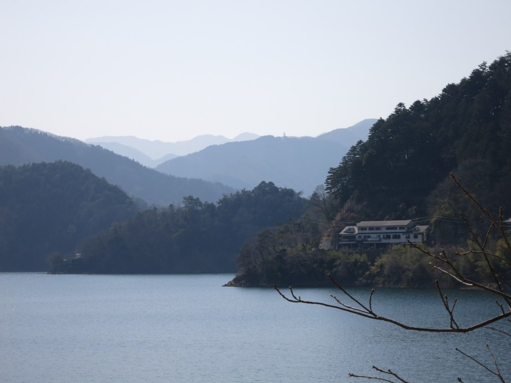
Lake Okutama is the reservoir created by the Ogouchi dam, completed in 1957 after the relocation of 945 households and the deaths of 87 workers, and it supplies about 20 per cent of Tokyo’s water. The dam itself is compact and handsome, a favourite of dam enthusiasts, and there is a small exhibition and viewing area. The lake has a walking route along part of its shore, the Ikoi-no-michi, about 12 kilometres from the dam to the Yama-no-furusato-mura outdoor centre, with benches and toilets along the way, though the section closes in winter when the road freezes. Two floating bridges, known as the drum-can bridges, cross narrow points of the lake and link the old Ome road with the Okutama circular road, but they are removed when the water level is low, so they cannot be relied on.
The forest therapy trails
Okutama was certified as a forest therapy base in 2008, the first in Tokyo, and has five designated trails, including a 1.3-kilometre route on Mount Nobori that was the first path in Japan built specifically for forest therapy, with wooden chips underfoot, benches for lying down, and a station with a wood stove. The others include the gorge walk, the old road, a route to the Hyakuhiro waterfall, and the lakeside path. This is not a gimmick industry: the town takes it seriously, runs guided walks, and the trails are maintained. For a visitor, the practical value is that the walking routes are signed and graded, which makes it easy to choose a two-hour walk rather than improvising on a mountain path.
Mount Mitake and the climbing
Okutama is also the southern approach to Mount Mitake, the mountain with the Musashi-Mitake shrine on top, reached by a cable car from Mitake station on the Ome line, which is a separate but adjacent trip and one of the easiest mountain shrines to visit from Tokyo. From Okutama itself, the serious climbing runs to Mount Kumotori, the highest point in Tokyo at 2,017 metres, which is usually done as an overnight or a very long day, and to Mount Kawanori, whose route passes the Hyakuhiro waterfall, a drop of about 40 metres that sometimes freezes in winter. The Kawanori trail is rough in places and has rock sections near the falls, so it is not the walk for a casual afternoon. Check conditions and carry proper footwear; the mountains here are real mountains, not parkland.
Food and drink
- Wasabi is the local crop, grown in the cold streams of Nippara and the surrounding valleys, and the shops sell wasabi paste, wasabi pickles and wasabi ice cream. The pickle, wasabi-zuke, is the traditional souvenir.
- Soba is the other local staple, served in the villages along the old road and at the lake, often with fresh wasabi to grate yourself.
- Trout and river fish are served grilled with salt at the fishing spots and inns along the Nippara river, and some fishing ponds let you catch your own and cook it.
- The cafes in the area are few but good: a couple near Hatonosu station with gorge views, one at the lake, and a small brewery in Hikawa with a taproom near the station.
- Food options close early and are concentrated near Okutama station and the lake. Carry something for the middle of the day if you are walking, since the old road has almost nothing on it.
- The Hikawa area around the station has a handful of restaurants serving set meals, soba and river fish, and it is the practical place to eat before or after a walk.
Getting there and around
- From Shinjuku, take the JR Chuo line to Tachikawa, then the JR Ome line to Okutama, about two hours in total. From Tokyo station, the same route takes about two hours fifteen.
- Note that the Ome line often requires a change at Ome, because the section from Tachikawa to Ome and the section from Ome to Okutama are operated as separate services. Some weekend trains run directly from Shinjuku to Okutama.
- Nippara cave is 35 minutes by bus from Okutama station, on the Nishi-Tokyo bus from the stop to the right of the station exit. On weekdays the bus goes to the cave; on weekends and holidays it terminates at Higashi-Nippara, a 25-minute walk from the cave.
- Hatonosu gorge is a ten-minute walk from Hatonosu station on the Ome line, one stop before Okutama, which makes it the easiest stop on the line without a car.
- Lake Okutama is about 20 minutes by bus from Okutama station, and buses also run along the lake and to the Okutama circular road. Services are infrequent, so check the return times before setting out.
- By car, the Chuo expressway to Hachioji, then Route 411 through Ome to Okutama, about 50 minutes from the Hinode or Ome interchange. The Nippara road is narrow with blind curves, and large vehicles are banned on weekends.
- The mountains are reached on foot from the station or by bus to the trailheads. There is no shuttle into the high country, so plan the day from the bus timetable rather than the map.
Where to stay
- Okutama station and the Hikawa area have the most accommodation: small inns, guesthouses and a few hotels, plus camping grounds along the river.
- Hatonosu has traditional inns with hot spring baths, including one with views over the gorge, which is the best base for the gorge walk and the cave.
- The lake area has the Yama-no-furusato-mura centre with cabins and tents, and a handful of lodges, which suits anyone walking the lakeside route.
- Nippara has minshuku and fishing lodges, quiet and convenient for the cave, but very limited in number and best booked ahead.
Best time to visit
- Spring brings new green along the gorge and the old road, and the wasabi fields are at their best. Cherry blossom comes later here than in central Tokyo because of the altitude.
- Summer is the busiest season, with camping, river swimming, kayaking and the cave as a cool refuge. The mountains are humid and the trails busy at weekends.
- Autumn is the best season for walking: maples along the gorge and the lake turn from late October, and the air is clear enough for the ridges.
- Winter is cold and quiet, with snow on the higher trails and the lakeside path closed when the road freezes. The cave stays at 11 degrees, which makes it more appealing in January than in August.
Practical tips
- Check whether your bus goes all the way to the cave or stops at Higashi-Nippara. The difference is a 25-minute walk, and it depends on the day.
- Take the old road one way and the bus back. Walking it in both directions is more than most people want in a day.
- Bring cash for the cave entrance, the buses and the small shops. Card acceptance is limited outside the station area.
- Wear shoes with grip on the old road and the gorge path. Both are uneven and muddy after rain, and the rock sections near the waterfall are genuinely slippery.
- Start early. The bus services are thin, the daylight goes early in the mountains, and the last bus back from the lake is in the late afternoon.
- If you want the cave without the crowd, go on a weekday when the bus reaches the entrance and the tour groups are absent.
- The mountains here are not city parkland: check the weather, tell someone your route, and do not attempt Kumotori or Kawanori without proper gear.
- Combine Hatonosu with Okutama rather than choosing between them. The stations are adjacent and the gorge walk takes an hour, which fits before or after the cave.
Suggested day-trip outline
- Morning: train from Shinjuku to Hatonosu, walk the gorge to Shira maru and back, then continue one stop to Okutama.
- Late morning: bus from Okutama station to Nippara cave, and an hour underground in the 11-degree passage.
- Lunch: soba or river fish in Nippara or back at Okutama station.
- Afternoon: walk the first half of the old road towards the lake, or take the bus to the Ogouchi dam and walk the lakeside path.
- Evening: bus back to Okutama station and the train to Shinjuku, or a night at a Hatonosu inn with a bath over the gorge.
Before you go
Timetables, fares, admission fees, and seasonal access rules can change. Check the official tourism and transport sites linked below for the latest information before you travel.
Explore More of Japan
Published guides that pair with this one:
- Mount Takao Travel Guide: A Temple Hike on the Edge of Tokyo
- Chichibu Travel Guide: A Mountain Town and a Night Festival
- Mount Tsukuba Travel Guide: The Twin Peaks North of Tokyo
- Yanaka, Nezu and Sendagi Travel Guide: Old Tokyo on Foot
- Meiji Jingu and Harajuku Travel Guide: Shrine Forest, Takeshita Street and Omotesando
- Tokyo Travel Guide: Neighborhoods, Transport and a First-Timer’s Plan
- Asakusa and Senso-ji Travel Guide: Temple Gates, Nakamise and the Sumida River
- Oze Travel Guide: Boardwalks and Wetlands in Gunma
Browse every Kanto guide on this site for the rest of the region.
Sources
- kankyo1.metro.tokyo.lg.jp (checked 2026-11-05)
- nippara.com (checked 2026-11-05)
- gotokyo.org (checked 2026-11-05)


Leave a Reply