Plan a day on Mount Tsukuba in Ibaraki, with the ropeway, the trails, the shrine and the views, plus access from Tokyo.
Operational details such as opening hours, admission fees, and train times can change. Prefer official pages and reconfirm before you travel (sources checked on 03 November 2026).
Why visit
- Mount Tsukuba is a pair of peaks rather than one mountain: Nantai-san at 871 metres and Nyotai-san at 877, joined by a saddle called Miyukigahara, and the whole mass is the object of worship at Tsukuba Shrine at its foot. The mountain has been a pilgrimage destination since the Nara period, and the shrine is one of the oldest in the Kanto region, which is why the approach is lined with inns and shops rather than with a car park. It is a sacred mountain that also happens to be an easy day out from Tokyo.
- The summit view is the specific reason most people go. The mountain stands alone on the northern edge of the Kanto Plain, with nothing of similar height between it and Tokyo, so the whole plain is laid out below: the towers of Shinjuku and Skyscraper District on a clear day, the Tone River, and the patchwork of fields and towns stretching to the horizon. It is one of the few places near Tokyo where you can see the plain as a plain rather than as a city.
- The two peaks give two different experiences. The cable car climbs to Nantai-san past a slope of giant boulders and odd-shaped rocks, with a viewpoint terrace partway, and the ropeway climbs to Nyotai-san from Tsutsujigaoka with the plain opening out below it. Taking one up and the other down is the standard route, and there is a connecting ticket for exactly that: the cable car and the ropeway each one way, for 1,860 yen for adults.
- The walking is better than the transport suggests. The Shirakumobashi course on the Nantai side is a scramble past named boulders, and the Miyukigahara course from Tsukuba Shrine is the old pilgrim route through forest. The ridge path between the two summits takes about 20 to 30 minutes and passes the Miyukigahara junction, where the two cable and ropeway lines meet the mountain. None of it is technical, and all of it is steep enough to feel like a mountain rather than a park.
- The shrine at the base is part of the visit rather than an afterthought. Tsukuba Shrine worships the two peaks themselves, and its main hall and the Omi-do stand at the foot of the mountain in a cedar grove, with the approach lined by shops selling the toad-oil charm and the sweet called gama-yu. The mountain and the shrine are one site, and walking from the shrine to the cable car station is a five-minute stretch of old approach road.
- The practical case is straightforward: it is about 45 minutes from Akihabara to Tsukuba on the Tsukuba Express, and a direct shuttle bus runs from the station to the shrine entrance and to the ropeway. For a mountain with a sacred history, a cable car, a ropeway and a summit view over the whole Kanto Plain, that is an unusually short journey from central Tokyo.
Top places and highlights
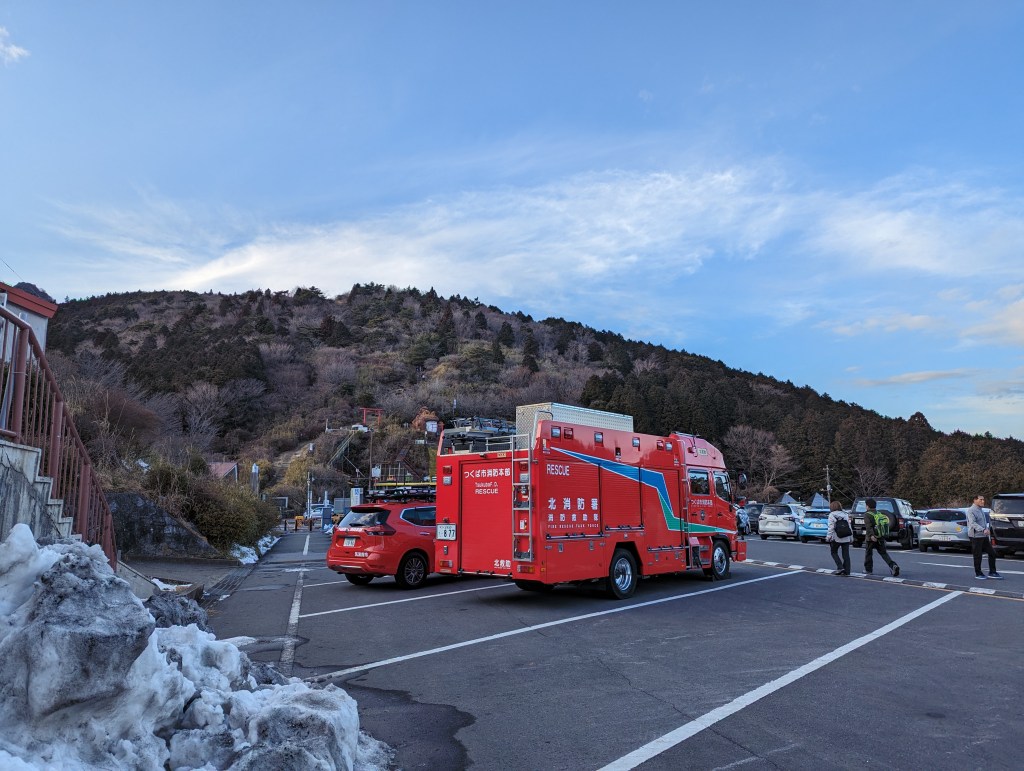
The summit view over the Kanto Plain
From the top of Nyotai-san the Kanto Plain opens out to the south and west, and on a clear day the Tokyo skyline, the Tone River and the mountains beyond are all visible. The Nantai side has a terrace at the top of the cable car with a similar view. It is the reason the mountain is busy on clear weekends, and the best months for it are the cold ones, when the haze is thin and Mount Fuji appears to the west.
The cable car and its boulder slope
The cable car climbs from Miyawaki station to Nantai-san in about six minutes, passing a slope of huge boulders and named rock formations that the mountain is known for. The fifth-generation car has been the one in service through 2026, when the operator ran a last-run campaign ahead of its replacement. The one-way fare is 930 yen for adults, and the return is 1,860.
The ropeway from Tsutsujigaoka
The ropeway runs from Tsutsujigaoka to near the top of Nyotai-san in about six minutes, and it is the ride with the better view of the plain, since it climbs the southern face. The fare is 930 yen one way and 1,860 return for adults, and the children’s fare is lower than the cable car’s, at 400 one way. The Tsutsujigaoka base has a restaurant, a cafe and the prefectural car park.
The ridge path between the peaks
The path between Nantai-san and Nyotai-san runs through the Miyukigahara saddle and takes roughly 20 to 30 minutes, with the summit of each peak a short climb from the junction. It is the part of the mountain that makes the two rides into a walk, and it is the reason to buy the connecting ticket rather than a return on one line. In winter the path can be icy, and the summits are exposed.
Tsukuba Shrine
Tsukuba Shrine at the foot of the mountain worships Nantai-san and Nyotai-san as its deities, and its main hall and Omi-do stand in a cedar grove at the start of the old pilgrim route. The approach is lined with shops selling the gama-yu sweet and the toad-oil charm that the mountain’s folk belief made famous. The shrine is free, it is five minutes from the cable car station, and it is where the mountain’s religious history is easiest to see.
The Shirakumobashi boulder course
The Shirakumobashi course climbs from the shrine side past named boulders and rock formations, and it is the most interesting of the walking routes because the geology is the attraction rather than the view. It is rated as an intermediate course and takes a couple of hours up, and it meets the cable car line partway at the terrace. Anyone wanting to walk rather than ride should take this one and come down by cable car.
The autumn night runs
The operator runs evening services in autumn and winter so that visitors can see the night view over the plain, with the lights of the towns below and the Tokyo glow on the horizon. The dates change by year and the service is cancelled in bad weather, so it has to be checked rather than assumed. It is the one time the mountain is quiet and the view is at its most distinctive.
Food and drink
- The Tsutsujigaoka base at the foot of the ropeway has a restaurant and a cafe, and the cable car side has shops at Miyawaki and at the summit station. These are the practical places to eat on the mountain, and they keep the hours of a mountain facility rather than a town restaurant.
- Gama-yu is the local sweet, a small steamed bun associated with the toad-oil charm sold on the shrine approach, and the shops along the old road sell it warm. It is the thing to buy at the foot of the mountain, and it is specific to Tsukuba rather than a generic souvenir.
- Tsukuba city has the full range of restaurants, including the ramen and soba shops that serve the research city’s population, and eating there before or after the mountain is cheaper and better than eating on the summit. The station area around Tsukuba Center is the concentration.
- The mountain’s own food is simple: soba, dango and mountain vegetables at the summit and base facilities, and the local sake of Ibaraki. Ibaraki is a major rice and sake prefecture, and the breweries around Tsukuba and Ishioka are worth a stop if you are driving.
Getting there and around
- Take the Tsukuba Express from Akihabara to Tsukuba, about 45 minutes on the fastest service, then the direct Mount Tsukuba shuttle bus from bus stop 1 outside exits A3 and A4 of the station. The shuttle runs daily and stops at Numata after about 29 minutes, Tsukuba Shrine entrance after about seven more, and Tsutsujigaoka after about 14 more.
- From Ueno, the JR Joban Line reaches Tsuchiura in about 70 minutes on a local train or 45 on a limited express, and a route bus from Tsuchiura station runs to Numata, Tsukuba Shrine entrance and Tsutsujigaoka. The return route requires changing at Numata for the bus back to Tsuchiura, which is a slower but cheaper option than the Tsukuba Express.
- By car, the routes are the Joban Expressway to Tsuchiura-kita and then Routes 125, 14 and 42 towards Tsukuba, or the Kita-Kanto Expressway to Sakuragawa-Chikusei, or the Ken-o Expressway to Joso or Tsukuba-Nishi smart interchange, each taking about 40 minutes from the interchange to the mountain.
- Set the navigation to Tsukuba Shrine for the cable car and to Tsukuba Keisei Hotel for the ropeway, because the mountain’s address is simply the whole mountain and satellite navigation otherwise picks odd routes. The operator warns that approaching from the north can send you down Prefectural Route 42, which is extremely narrow.
- Parking is paid and split between two operators: the city car park on the cable car side charges 500 yen a day for standard cars and is open 5:00 to 20:00, while the prefectural car park at Tsutsujigaoka charges 700 yen per entry with the first ten minutes free and is open from 9:00, until 18:00 on weekdays and 19:00 at weekends from April to November.
Where to stay
- Tsukuba city has business hotels around Tsukuba Station and the research institutes, which is the practical base for an early start on the mountain. It is a planned city with wide roads and a lot of green space, and it is not a tourist town.
- The inns on the shrine approach at the foot of the mountain are the traditional option, and staying there means walking to the cable car in the morning before the buses arrive. The number is small and they fill at foliage season and on clear winter weekends.
- Tsuchiura, on the Joban Line, is the other base, with hotels and a castle park and a slower, older town centre than Tsukuba’s. It suits anyone arriving from Ueno by train rather than by the Tsukuba Express.
Best time to visit
- Autumn is the strongest season, with the foliage on the slopes, the clearest air of the year beginning in November, and the operator’s night runs. The mountain is busy at weekends in November, and the car parks and the cable car queue build through the morning.
- Winter gives the best views, with the plain at its clearest and Mount Fuji visible to the west on cold days, and it is also when the summit is at its coldest and the ridge path can be icy. The night runs continue into this season, and the mountain is at its quietest on weekdays.
- Spring brings the plum and cherry on the lower slopes and the new green on the mountain, and it is a good season for walking the Shirakumobashi course. The weather is changeable, and the summit can be in cloud while the plain below is clear.
- Summer is hot and humid on the plain and cooler on the ridge, which makes it the season for walking rather than riding, with the forest trails shaded. The trade is haze, which flattens the view from the summit, and the afternoon thunderstorms that build over the Kanto Plain.
Practical tips
- Buy the connecting one-way ticket if you are using both lines. The cable car and the ropeway each one way costs 1,860 yen for adults and 870 for children, which is the same as a return on one line, and it lets you go up one side and down the other. It is sold at Miyawaki and Tsutsujigaoka stations, and it is designed for bus passengers who arrive at one base and leave from the other.
- Set the navigation carefully if you are driving. The mountain’s registered address covers the whole mass, so the operator advises entering Tsukuba Shrine for the cable car and Tsukuba Keisei Hotel for the ropeway. Without that, satellite navigation can route you to a road on the wrong side of the mountain.
- Expect to pay for parking, and pay before you park at the cable car side. The city car park is 500 yen a day and uses a pre-payment system at the first, third and fourth car parks, with no reservations and no refunds. The Tsutsujigaoka car park is 700 yen per entry, with the first ten minutes free.
- Check the operating status on the day. Both lines are normally open every day, but they stop temporarily in strong wind, heavy snow or lightning, and the cable car takes a maintenance break of about a week in winter. The operator posts the status and the timetable, including the special November schedule.
- Walk the ridge if you can. The path between Nantai-san and Nyotai-san takes 20 to 30 minutes through the Miyukigahara saddle, and it is what turns two cable car rides into a mountain walk. In winter it can be icy, and the summits are exposed to the wind.
- Do not skip the shrine at the base. Tsukuba Shrine is free, it is five minutes from the cable car station, and it is the reason the mountain has been visited for over a thousand years. The approach shops and the cedar grove are the part of the visit that most day-trippers miss.
- Allow for the bus, not just the train. The Tsukuba Express takes 45 minutes from Akihabara, but the shuttle from Tsukuba Station to Tsutsujigaoka takes about 50 minutes in total, with stops at Numata and the shrine entrance. The round trip from central Tokyo is a full day rather than a half day.
Suggested day-trip outline
- Take the Tsukuba Express from Akihabara to Tsukuba, then the shuttle bus from stop 1 to Tsukuba Shrine entrance, about seven minutes after Numata. Start at the shrine, see the main hall and the Omi-do in the cedar grove, and walk the five minutes to the cable car station at Miyawaki.
- Ride the cable car up to Nantai-san, stopping at the terrace partway for the boulder slope and the first view of the plain. At the top, walk the short climb to the summit and then take the ridge path through Miyukigahara to Nyotai-san, which takes about 20 to 30 minutes.
- Descend by the ropeway to Tsutsujigaoka, where the view opens over the southern plain and the restaurant and cafe are. This is the route the connecting ticket is designed for, and it means you see both faces of the mountain rather than going up and down the same line.
- If you are walking rather than riding, go up the Shirakumobashi course from the shrine side, which takes a couple of hours past the named boulders, and come down by cable car. The reverse, up by cable car and down on foot, is harder on the knees and takes longer than the ascent.
- Eat at Tsutsujigaoka or back in Tsukuba city, buy gama-yu on the shrine approach, and take the shuttle bus back to Tsukuba Station. In autumn or winter, check whether the night run is operating and stay for the view over the lights of the plain before the last bus.
Before you go
Timetables, fares, admission fees, and seasonal access rules can change. Check the official tourism and transport sites linked below for the latest information before you travel.
Explore More of Japan
Published guides that pair with this one:
- Mount Nokogiri and Nihonji Travel Guide: Cliffs, Carvings, and the Boso Peninsula
- Nikko Travel Guide: Toshogu Shrine, Waterfalls, and a Tokyo Day Trip
- Kamakura Travel Guide: Great Buddha, Temples, and a Tokyo Day Trip
- Tokyo Travel Guide: Neighborhoods, Transport and a First-Timer’s Plan
- Ashikaga Flower Park Guide: The Wisteria Tunnels and When to Go
- Oze Travel Guide: Boardwalks and Wetlands in Gunma
- Meiji Jingu and Harajuku Travel Guide: Shrine Forest, Takeshita Street and Omotesando
- Railway Museum Omiya Travel Guide: Highlights, Access, and Planning
- Ikaho Onsen Guide: Gunma’s Stone-Step Hot Spring Town
- Nagatoro Guide: The Arakawa River and Saitama’s Stone Town
Browse every Kanto guide on this site for the rest of the region.
Sources
- mt-tsukuba.com (checked 2026-11-03)
- mt-tsukuba.com (checked 2026-11-03)
- mt-tsukuba.com — Access (checked 2026-11-03)
- city.tsukuba.lg.jp (checked 2026-11-03)


Leave a Reply