A practical English guide to Ryusendo cave in Iwaizumi, Iwate: the limestone passages, the underground lakes, the walkway and access by bus or car.
Operational details such as opening hours, admission fees, and train times can change. Prefer official pages and reconfirm before you travel (sources checked on 05 November 2026).
Why visit
- Ryusendo is a limestone cave in the mountains of eastern Iwate, and it holds some of the clearest underground water in Japan. The cave runs back into the hillside for kilometres, and the show cave section follows a walkway past three underground lakes, the deepest of which goes down more than a hundred metres. The water is so transparent that the surface is almost invisible, and the lights on the far wall seem to float in mid-air.
- It is not a theme-park cave. There are no coloured lights and no music, the walkway is wet and the temperature stays around ten degrees all year, and the formations are left as they are, with labels naming the stalactites and the lakes. The first lake is shallow, the second and third are deep shafts of water with the rock disappearing into blackness below, and the effect is closer to a cathedral than an attraction.
- The cave is also a scientific site. It is a hibernation site for bats, and the water has been studied for its clarity and its chemistry, with instruments and records going back decades. A small museum at the entrance explains the geology and the exploration, and the cave continues beyond the public route into passages used by divers and survey teams.
- The surrounding valley is quiet and green, with a river, a hot spring and a small town, and the drive from Morioka or the train to Iwaizumi is part of the trip. Ryusendo is one of the few places in Tohoku where a natural sight is genuinely world class, and it is often skipped because it is not on the shinkansen.
Top places and highlights
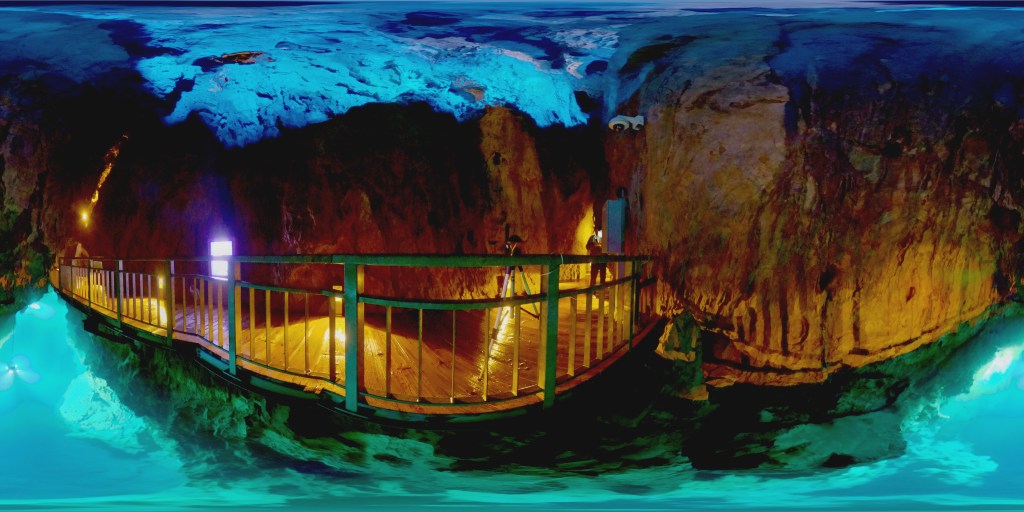
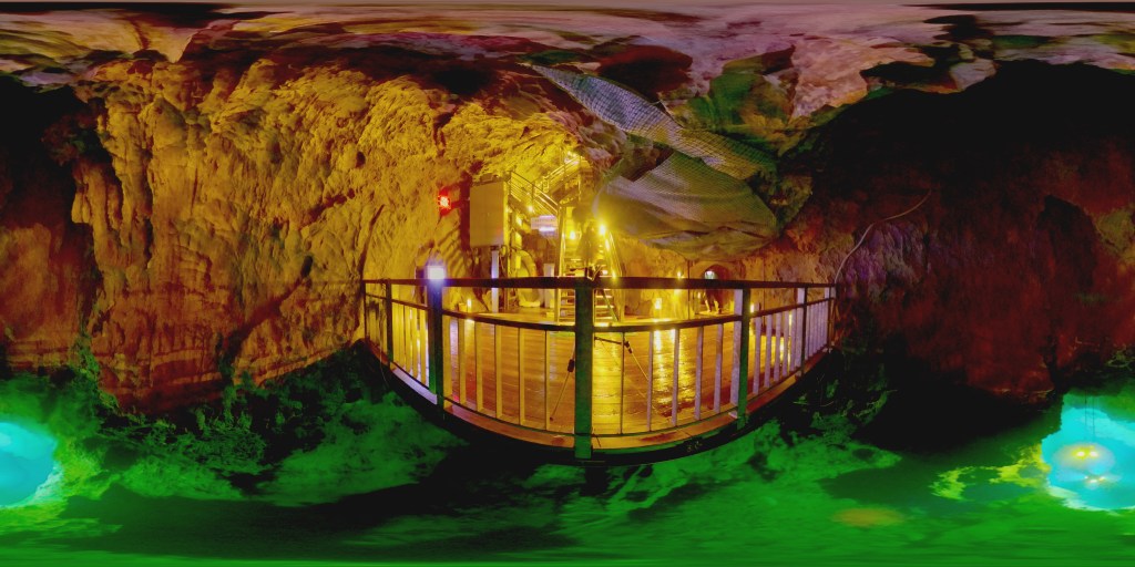
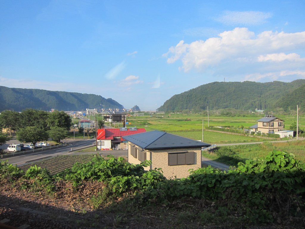
The underground lakes
The public route passes three lakes, and each has a different character. The first is shallow and green, with the roof reflected in it; the second and third are deep shafts where the water goes down into darkness and the far wall is lit so that you can see how far it falls. The clarity is the thing: you can see the rock below the surface, and the line between water and air is hard to find. Lean over the rail and look straight down, and then look at the reflection of the ceiling. The lights are placed to show the depth rather than to decorate it.
The walkway and the formations
The path runs for several hundred metres through the cave, with steps, low ceilings and wet rock underfoot, and it passes stalactites, flowstone and columns that have been growing for tens of thousands of years. Some are named and lit, others are left in shadow, and the route is one-way in busy periods. The cave is cool and humid, water drips constantly, and the sound of it is everywhere. Take your time at the wider chambers, where the space opens up and the scale becomes clear.
The clarity of the water
The water in the lakes is exceptionally clear because it is filtered through limestone and moves slowly, and the cave has been used as a benchmark for water clarity in Japan. Photographers come here for the effect, and it is best seen when the surface is still and the lights are reflected. Do not touch the water: the oils on your skin affect the surface and the ecology, and the cave asks visitors not to. The best photographs are taken from the railings with a steady hand and a long exposure, and tripods are not allowed on the route.
The cave museum
The small museum at the entrance covers the geology of the limestone, the formation of the caves, the exploration of the deeper passages and the bats that hibernate here. There are maps, survey drawings, equipment used by the divers and photographs of parts of the cave that visitors never see. It is modest and mostly in Japanese, but the maps alone make the scale clear. It is a good place to wait out a shower or to spend twenty minutes before or after the walk.
The valley and the river
The cave sits in a narrow valley with a river running past the car park, and the road in from Iwaizumi follows the water through forest and small settlements. In summer the valley is green and cool, in autumn it turns, and in winter the road is cleared but the sides are deep in snow. There are pull-offs and a few places to eat near the cave, and the walk along the river bank is a pleasant way to spend an hour after the cave.
The hot spring and the town
Iwaizumi and the surrounding valley have small hot spring inns, some with outdoor baths beside the river, and they are the natural place to stay after the cave. The town is small and quiet, with a few shops and restaurants, and the local specialty is the water itself, sold in bottles and used for coffee and sake. It is not a destination in its own right, but as part of a night in the valley it works well.
The drive from Morioka
The road from Morioka runs east through the mountains, past the turn-off for the Hayachine range and through long stretches of forest, and it is one of the better drives in the region. In autumn the colour is strong, and in winter the snow walls along the road can be several metres high. There are few services, so fill up before you leave and carry water and a snack. The train to Iwaizumi and the bus from there is the alternative if you do not have a car.
Food and drink
- The restaurants near the cave and in Iwaizumi serve simple set meals, soba, ramen and grilled river fish, and they close early. Eat before the cave or straight after, since the options are limited in the afternoon.
- Iwate’s local dishes are worth looking for in the wider area: wanko soba, the small bowls of noodles served in a competitive style, and the cold noodles and hot pots of the inland towns. Morioka is the place for those, and it is an hour away.
- The valley produces vegetables and mushrooms, and the mountain vegetables, sansai, appear in the set meals in spring. The local water is excellent, and the coffee and the sake made with it are a small point of pride.
- For a picnic, buy food in Iwaizumi or Morioka before the drive, and eat by the river rather than at the cave, where the seating is limited.
- Morioka has the best restaurants in the region, including the noodle shops and the bars around the station, and it is the place to eat a proper dinner after a day in the valley.
Getting there and around
- The nearest station is Iwaizumi on the JR Iwaizumi line, reached from Morioka by train with a change, in about an hour and a half to two hours depending on connections. The cave is a short bus or taxi ride from the station.
- Buses run from Iwaizumi station to Ryusendo during the season, with a timetable that is thin outside the summer months. Check the return times before you set out, since the last bus is early.
- By car, the cave is about an hour and a half from Morioka on the national road, with a large car park at the entrance. A car is the practical way to combine the cave with the surrounding valley and the hot springs.
- From the coast at Miyako, the road inland to Iwaizumi takes about an hour, which makes the cave a possible stop on a trip between the Sanriku coast and Morioka.
- The cave is a one-way route with stairs and wet floors, and it is not fully accessible for wheelchairs or pushchairs. Check the current access arrangements if you have mobility needs.
Where to stay
- The hot spring inns in the Iwaizumi valley are the best option: small, traditional, with outdoor baths and dinner, and within a short drive of the cave. They are quiet and best booked ahead in autumn.
- Morioka has the widest range of hotels, from business chains to larger city hotels, and it is a comfortable base for the cave and the surrounding mountains. The drive is about an hour and a half.
- Miyako on the coast has hotels and a fishing port, and it is a good base for combining the Sanriku coast with the cave. The drive inland is about an hour.
- Camping and simple lodges are available in the valley in summer, and they suit travellers with a car who want to be close to the cave at opening time.
Best time to visit
- Summer, from July to August, is the busiest and the easiest season: the roads are clear, the valley is green, and the cave is a cool refuge from the heat. Expect queues at the entrance in the middle of the day.
- Autumn, from late October to early November, is the best time for the drive, with colour in the forest and clear air. The cave is quieter outside the holiday weekends.
- Winter is cold and snowy, and the road in is cleared but the valley is deep in snow. The cave stays around ten degrees, which feels warm compared with the outside, and the crowds are gone. Check that the cave is open before you travel.
- Spring arrives late in the mountains, with snow melting through April and the first green in May. The cave is open and quiet, and the waterfalls and the river are full.
- The rainy season runs from early June to mid-July, with wet weather and high humidity. The cave is unaffected by rain, which makes it a good wet-weather destination, but the drive needs care.
Practical tips
- Wear shoes with grip and a jacket. The cave is around ten degrees, the path is wet, and there are low ceilings and stairs.
- Do not touch the water or the formations. The cave asks visitors to keep their hands off, and the clarity depends on it.
- Check the bus timetable before you rely on public transport. The service is infrequent and the last bus leaves early.
- Bring cash for the entrance fee and the small shops, since card payment is not universal in the valley.
- Allow an hour for the cave and another for the museum and the river, plus the drive. It is a half-day rather than a full one.
- If you are driving in winter, check the road and weather conditions and carry the right tyres. The valley is remote and the snow can be heavy.
Suggested day-trip outline
- Morning: drive or train from Morioka to Iwaizumi, then on to the cave, arriving at opening time to avoid the queues.
- Late morning: the cave walk, then the museum and a short walk along the river.
- Lunch: a set meal near the cave or in Iwaizumi, before the restaurants close.
- Afternoon: the hot spring for a bath, or the drive back towards Morioka with a stop at a roadside station.
- Evening: dinner in Morioka, with wanko soba or the local noodles, and a walk along the river in the city.
- With more time: the Sanriku coast at Miyako, or the Hayachine range for walking in summer.
Before you go
Timetables, fares, admission fees, and seasonal access rules can change. Check the official tourism and transport sites linked below for the latest information before you travel.
Explore More of Japan
Published guides that pair with this one:
- Lake Towada Travel Guide: Oirase Stream, Autumn Colour and the Calm Side of Aomori
- Kakunodate Travel Guide: Samurai Streets and Weeping Cherries
- Hiraizumi Travel Guide: UNESCO Temples and Gardens in Iwate
- Sanriku Coast Travel Guide: Jodogahama, Kitayamazaki and the Sanriku Railway
- Oirase Gorge Travel Guide: Stream Walks toward Lake Towada
- Zao Onsen Guide: Snow Monsters, Skiing, and the Ropeway
Browse every Tohoku guide on this site for the rest of the region.
Sources
- iwate-ryusendo.jp (checked 2026-11-05)


Leave a Reply